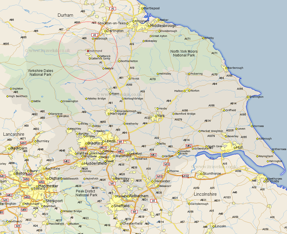
Yorkshire Map Showing Location of Richmond
Population: 7802
Area Size (ha): 195
District: Richmondshire
Easting: 417310 Northing: 500552
Latitude: 54.4 Longitude: -1.73
 = Richmond
Area Size (ha): 195
District: Richmondshire
Easting: 417310 Northing: 500552
Latitude: 54.4 Longitude: -1.73
= Richmond
This Richmond map below is supplied by Google. Use the tools in the top left corner to zoom into street level or zoom out for a road map, you may also need to zoom in to see Richmond on the map. Click and drag the map to move around. If the map fails to load try and refresh your browser or zoom in or out (+ or -).
Update - it seems Google no longer allow people to use their maps for free! This Richmond map sometimes loads and sometimes gives a error. I am working on a solution.
Closest 30 Towns or Cities to Richmond (Population over 500)
Gilling 3.86km Catterick 7.46km Middleton Tyas 7.74km Scorton 8.83km Barton 9.17km Melsonby 9.81km North Cowton 11.87km Leyburn 12.36km East Cowton 13.08km Cowton 13.08km Crakehall 13.45km Middleham 14.06km Bedale 16.22km Northallerton 20.8km Masham 21.09km Brompton 21.25km Grewelthorpe 24.7km Tanfield 24.73km West Tanfield 24.73km Bradley 25.39km Kirkby Malzeard 26.5km Osmotherley 28.3km Middleton upon Leven 31.08km Middleton 31.08km Whorlton 31.33km Hawes 32.22km Thirsk 33km Topcliffe 33.12km Seamer 34.23km Ripon 34.5km