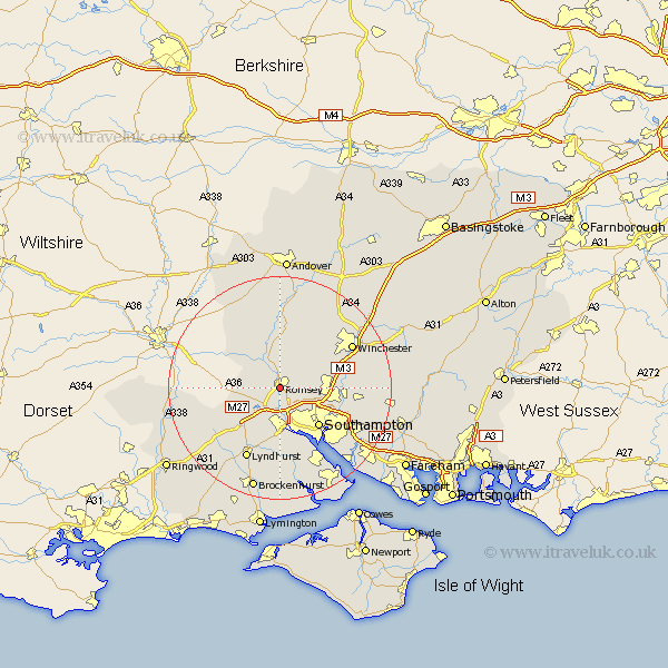
Hampshire Map Showing Location of Romsey
Population: 16639
Area Size (ha): 460
District: Test Valley
Easting: 435093 Northing: 120612
Latitude: 50.98 Longitude: -1.5
 = Romsey
Area Size (ha): 460
District: Test Valley
Easting: 435093 Northing: 120612
Latitude: 50.98 Longitude: -1.5
= Romsey
This Romsey map below is supplied by Google. Use the tools in the top left corner to zoom into street level or zoom out for a road map, you may also need to zoom in to see Romsey on the map. Click and drag the map to move around. If the map fails to load try and refresh your browser or zoom in or out (+ or -).
Update - it seems Google no longer allow people to use their maps for free! This Romsey map sometimes loads and sometimes gives a error. I am working on a solution.
Closest 30 Towns or Cities to Romsey (Population over 500)
Michelmersh 5.56km Michlemersh 5.56km Sherfield English 5.83km West Wellow 6.12km Chilworth 6.91km Totton 7.5km Hursley 7.92km Eling 9.34km Kings Somborne 9.35km Cadnam 9.43km Bramshaw 9.88km Southampton 9.93km Otterbourne 10.66km Eastleigh 10.66km Broughton 11.66km Bishopstoke 11.81km Marchwood 12.06km Compton 12.24km Sparsholt 12.35km Itchen 12.35km Stockbridge 13.03km Minstead 13.14km Twyford 13.36km Dibden 13.78km West End 13.83km Lyndhurst 14.22km Hythe 14.74km Winchester 15.2km Nether Wallop 15.55km Owslebury 16.44km