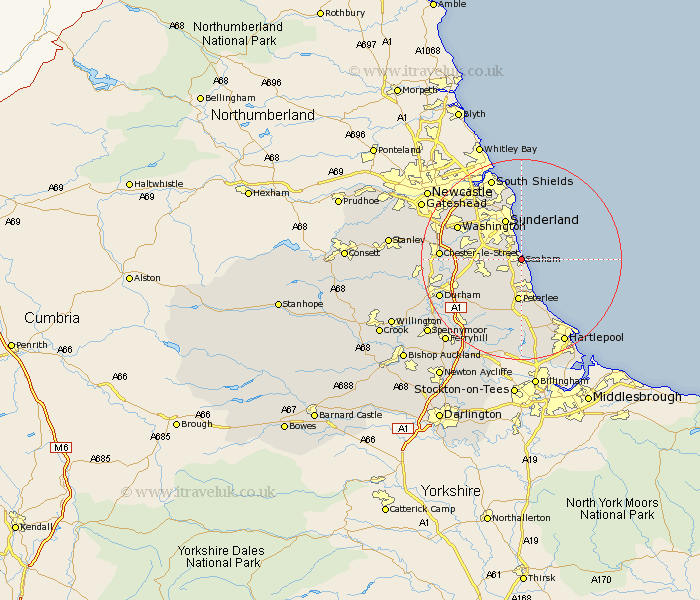
Durham Map Showing Location of Seaham Harbour
Population: 21845
Area Size (ha): 461
District: Easington
Easting: 442510 Northing: 549308
Latitude: 54.84 Longitude: -1.34
 = Seaham Harbour
Area Size (ha): 461
District: Easington
Easting: 442510 Northing: 549308
Latitude: 54.84 Longitude: -1.34
= Seaham Harbour
This Seaham Harbour map below is supplied by Google. Use the tools in the top left corner to zoom into street level or zoom out for a road map, you may also need to zoom in to see Seaham Harbour on the map. Click and drag the map to move around. If the map fails to load try and refresh your browser or zoom in or out (+ or -).
Update - it seems Google no longer allow people to use their maps for free! This Seaham Harbour map sometimes loads and sometimes gives a error. I am working on a solution.
Closest 30 Towns or Cities to Seaham Harbour (Population over 500)
Dalton le Dale 2.88km Dalton 2.88km Seaton 2.92km Murton 5.5km South Hetton 5.69km Easington 5.87km Shotton 6.21km Hetton le Hole 7.51km Haswell 7.79km Peterlee 8.31km Houghton le Spring 8.37km Sunderland 8.85km Hesleden 9.74km Pittington 10.16km Horden 10.26km West Rainton 10.61km Thornley 11.41km Wingate 11.86km Sherburn 12.14km Whitburn 13.11km Hutton Henry 13.37km Washington New Town 13.42km Washington 13.42km Hart 14.11km Marsden 14.57km Chester-le-Street 14.71km Shincliffe 14.74km West Boldon 15.05km Boldon 15.05km Birtley 15.52km