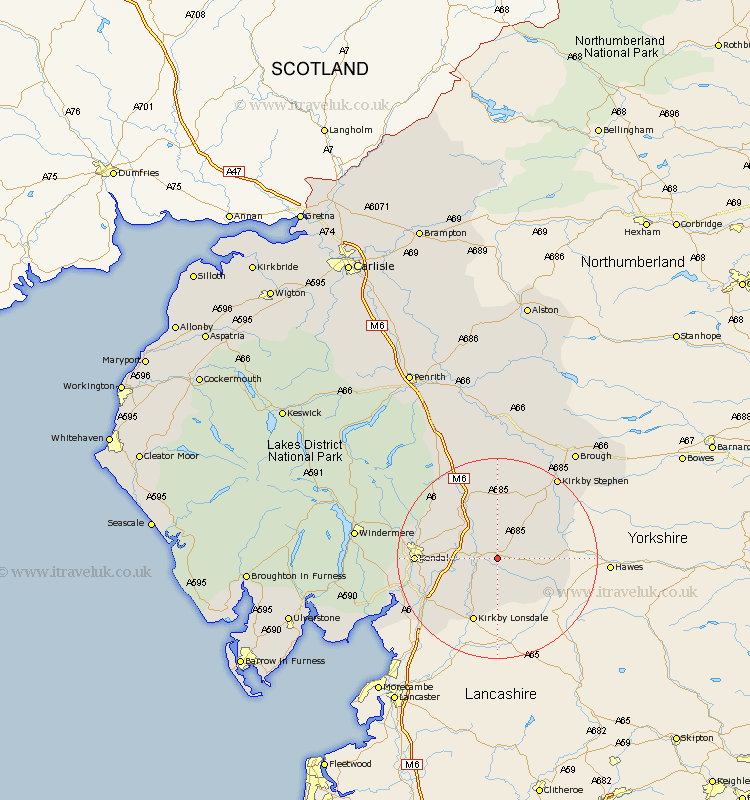
Cumbria Map Showing Location of Sedbergh
Population: 2213
Area Size (ha): 60
District: South Lakeland
Easting: 366393 Northing: 491374
Latitude: 54.32 Longitude: -2.52
 = Sedbergh
Area Size (ha): 60
District: South Lakeland
Easting: 366393 Northing: 491374
Latitude: 54.32 Longitude: -2.52
= Sedbergh
This Sedbergh map below is supplied by Google. Use the tools in the top left corner to zoom into street level or zoom out for a road map, you may also need to zoom in to see Sedbergh on the map. Click and drag the map to move around. If the map fails to load try and refresh your browser or zoom in or out (+ or -).
Update - it seems Google no longer allow people to use their maps for free! This Sedbergh map sometimes loads and sometimes gives a error. I am working on a solution.
Closest 30 Towns or Cities to Sedbergh (Population over 500)
Dent 7.04km Tebay 11.93km Ravenstonedale 12.87km Kirkby Londsdale 13.68km Kirkby Lonsdale 13.68km Natland 14.54km Kendall 15.13km Kendal 15.13km Orton 16.99km Heversham 18.69km Levens 18.83km Milnthorpe 19.68km Holme 19.72km Kirkby Stephen 19.87km Staveley 20.23km Beetham 20.79km Crosby Ravensworth 22.65km Shap 24.26km Arnside 25.36km Brough 26.29km Windermere 26.52km Appleby 27.88km Ambleside 31.2km Long Marton 31.5km Long Marston 31.5km Hawkshead 31.82km Lower Holker 32.78km Holker 32.78km Kirkby Thore 33.43km Haverthwaite 33.76km