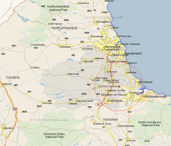
Durham Map Showing Location of Sedgefield
Population: 4324
Area Size (ha): 112
District: Sedgefield
Easting: 436559 Northing: 528482
Latitude: 54.65 Longitude: -1.43
 = Sedgefield
Area Size (ha): 112
District: Sedgefield
Easting: 436559 Northing: 528482
Latitude: 54.65 Longitude: -1.43
= Sedgefield
This Sedgefield map below is supplied by Google. Use the tools in the top left corner to zoom into street level or zoom out for a road map, you may also need to zoom in to see Sedgefield on the map. Click and drag the map to move around. If the map fails to load try and refresh your browser or zoom in or out (+ or -).
Update - it seems Google no longer allow people to use their maps for free! This Sedgefield map sometimes loads and sometimes gives a error. I am working on a solution.
Closest 30 Towns or Cities to Sedgefield (Population over 500)
Fishburn 3.7km Bishop Middleham 4.9km Grindon 4.91km Stillington 5.56km Trimdon 5.66km West Cornforth 7.72km Cornforth 7.72km Carlton 7.72km Ferryhill 8.37km Coxhoe 8.56km Stockton on Tees 8.91km Stockton 8.91km Stockton-on-Tees 8.91km Hutton Henry 9.15km Newton Aycliffe 9.35km Wingate 9.8km Billingham on Tees 10.23km Billingham-on-Tees 10.23km Billingham 10.23km Elwick 10.33km Wolviston 10.34km Bowburn 10.7km Thornley 11.12km Spennymoor 12.04km Greatham 13km Hart 13.03km Sherburn 13.37km Hesleden 13.41km Peterlee 13.64km Eaglescliffe 14.04km