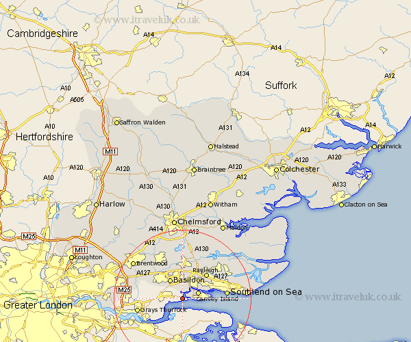
Essex Map Showing Location of Shell Haven
Easting: 574595 Northing: 182809
Latitude: 51.52 Longitude: 0.52
 = Shell Haven
Latitude: 51.52 Longitude: 0.52
= Shell Haven
This Shell Haven map below is supplied by Google. Use the tools in the top left corner to zoom into street level or zoom out for a road map, you may also need to zoom in to see Shell Haven on the map. Click and drag the map to move around. If the map fails to load try and refresh your browser or zoom in or out (+ or -).
Update - it seems Google no longer allow people to use their maps for free! This Shell Haven map sometimes loads and sometimes gives a error. I am working on a solution.
Closest 30 Towns or Cities to Shell Haven (Population over 500)
Benfleet 2.95km South Benfleet 2.95km Corringham 4.59km Canvey Island 4.97km Basildon 6.55km Stanford le Hope 7.17km Wickford 9.26km Rawreth 9.89km Great Burstead 10.13km Rayleigh 10.13km Leigh-on-Sea 11.02km Leigh 11.02km Leigh on Sea 11.02km Hockley 11.82km Ramsden Heath 12.03km Hawkwell 12.74km Tilbury Fort 12.76km Tilbury 12.76km Southend 12.82km Southend on Sea 12.82km Southend-on-Sea 12.82km South Hanningfield 12.96km Billericay 13.09km Grays 13.22km Grays Thurrock 13.22km Herongate 14.47km Ingrave 14.68km West Hanningfield 14.87km Rettendon 15km South Ockedon 15.11km