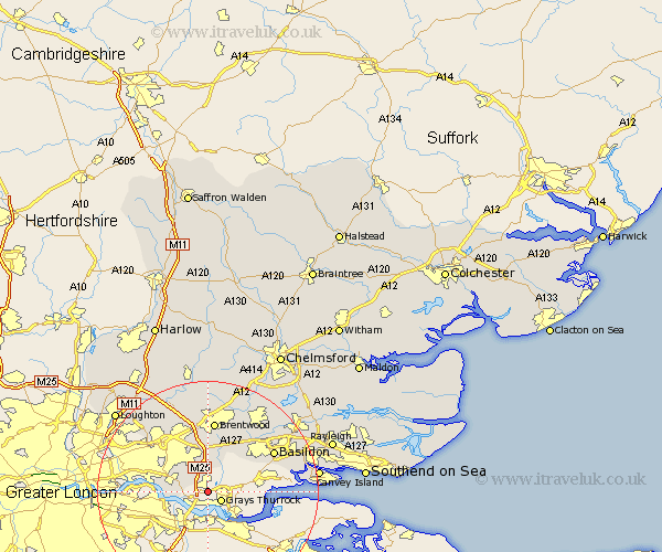
Essex Map Showing Location of South Ockendon
Population: 15031
Area Size (ha): 322
Easting: 559624 Northing: 180457
Latitude: 51.5 Longitude: 0.3
 = South Ockendon
Area Size (ha): 322
Easting: 559624 Northing: 180457
Latitude: 51.5 Longitude: 0.3
= South Ockendon
This South Ockendon map below is supplied by Google. Use the tools in the top left corner to zoom into street level or zoom out for a road map, you may also need to zoom in to see South Ockendon on the map. Click and drag the map to move around. If the map fails to load try and refresh your browser or zoom in or out (+ or -).
Update - it seems Google no longer allow people to use their maps for free! This South Ockendon map sometimes loads and sometimes gives a error. I am working on a solution.
Closest 30 Towns or Cities to South Ockendon (Population over 500)
Grays Thurrock 2.96km Grays 2.96km Aveley 3.93km Tilbury 7.23km Tilbury Fort 7.23km Stanford le Hope 8.08km Ingrave 9.55km Herongate 9.83km Corringham 10.65km Great Burstead 12.28km Brentwood 13.03km Basildon 13.71km Mountnessing 15.22km Billericay 15.28km Navestock 15.52km Ramsden Heath 16.61km South Benfleet 17.69km Benfleet 17.69km Kelvedon Hatch 18.57km Wickford 18.66km Stock 19.06km Ingatestone 19.41km Stanford Rivers 19.41km Chigwell 19.82km Canvey Island 19.95km South Hanningfield 21.07km Rawreth 21.53km West Hanningfield 21.66km Loughton 21.9km Margaretting 21.92km