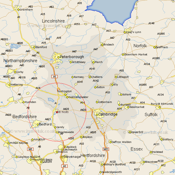
Cambridgeshire Map Showing Location of St. Neots
Population: 13124
Area Size (ha): 325
District: Huntingdonshire
Easting: 518402 Northing: 259069
Latitude: 52.22 Longitude: -0.27
 = St. Neots
Area Size (ha): 325
District: Huntingdonshire
Easting: 518402 Northing: 259069
Latitude: 52.22 Longitude: -0.27
= St. Neots
This St. Neots map below is supplied by Google. Use the tools in the top left corner to zoom into street level or zoom out for a road map, you may also need to zoom in to see St. Neots on the map. Click and drag the map to move around. If the map fails to load try and refresh your browser or zoom in or out (+ or -).
Update - it seems Google no longer allow people to use their maps for free! This St. Neots map sometimes loads and sometimes gives a error. I am working on a solution.
Closest 30 Towns or Cities to St. Neots (Population over 500)
Eaton Socon 1.14km Hail Weston 2.17km Little Paxton 3.87km Great Paxton 5.03km Great Staughton 7.18km Buckden 7.49km Offord Cluny 8.69km Offord 8.69km Graffham 9.33km Grafham 9.33km Gamlingay 9.34km Great Gransden 9.82km Gransden 9.82km Papworth Everard 10.38km Papworth 10.38km Ellington 11.18km Brampton Grange 11.35km Brampton 11.35km Kimbolton 12.2km Hilton 12.64km Godmanchester 13.04km Durolipons 13.04km Spaldwick 13.74km Elsworth 14.11km Huntingdon 14.15km Hemingford Grey 15.09km Hemingford 15.09km Bourn 15.23km Hemingford Abbots 15.88km West Hemingford 15.88km