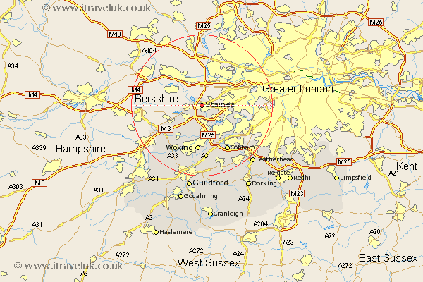
Surrey Map Showing Location of Staines
Population: 50236
Area Size (ha): 1501
District: Spelthorne
Easting: 503099 Northing: 171575
Latitude: 51.43 Longitude: -0.52
 = Staines
Area Size (ha): 1501
District: Spelthorne
Easting: 503099 Northing: 171575
Latitude: 51.43 Longitude: -0.52
= Staines
This Staines map below is supplied by Google. Use the tools in the top left corner to zoom into street level or zoom out for a road map, you may also need to zoom in to see Staines on the map. Click and drag the map to move around. If the map fails to load try and refresh your browser or zoom in or out (+ or -).
Update - it seems Google no longer allow people to use their maps for free! This Staines map sometimes loads and sometimes gives a error. I am working on a solution.
Closest 30 Towns or Cities to Staines (Population over 500)
Egham 3.93km Chertsey 5.68km Virginia Water 6.86km Shepperton 7.23km Addlestone 7.76km Walton upon Thames 8.02km Walton 8.02km Weybridge 8.18km Lower Sunbury 8.9km Sunbury 8.9km Sunbury-on-Thames 8.9km Sunbury on Thames 8.9km Ottershaw 9.33km Byfleet 11.65km Windlesham 11.85km Molesey 12.14km Chobham 12.53km Woking 13.02km Bagshot 13.73km Bisley 13.75km Esher 13.93km Church Cobham 14.71km Cobham 14.71km Claygate 14.82km Send 16.72km Ripley 16.84km Oxshott 17.38km Worplesdon 17.65km Camberly 17.66km Camberley 17.66km