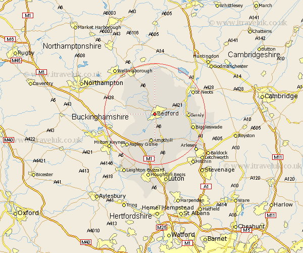
Bedfordshire Map Showing Location of Bedford
Population: 73994
Area Size (ha): 1765
District: Bedford
Easting: 506078 Northing: 249511
Latitude: 52.13 Longitude: -0.48
 = Bedford
Area Size (ha): 1765
District: Bedford
Easting: 506078 Northing: 249511
Latitude: 52.13 Longitude: -0.48
= Bedford
This Bedford map below is supplied by Google. Use the tools in the top left corner to zoom into street level or zoom out for a road map, you may also need to zoom in to see Bedford on the map. Click and drag the map to move around. If the map fails to load try and refresh your browser or zoom in or out (+ or -).
Update - it seems Google no longer allow people to use their maps for free! This Bedford map sometimes loads and sometimes gives a error. I am working on a solution.
Closest 30 Towns or Cities to Bedford (Population over 500)
Biddenham 1.37km Clapham 1.87km Bromham 3.12km Kempston 3.71km Elstow 3.81km Oakley 4.48km Stevington 6.05km Milton Ernest 6.1km Wootton 6.1km Cople 6.85km Pavenham 7.33km Thurleigh 7.69km Willington 7.74km Wilstead 8.06km Wilshamstead 8.06km Willshamstead 8.06km Wilhamstead 8.06km Great Barford 9.06km Houghton Conquest 9.31km Carlton 9.9km Harrold 9.9km Sharnbrook 9.96km Haynes 10.22km Marston Moretaine 10.42km Bolnhurst 10.76km Cranfield 11.05km Turvey 11.1km Blunham 11.15km Ampthill 11.2km Northill 11.75km