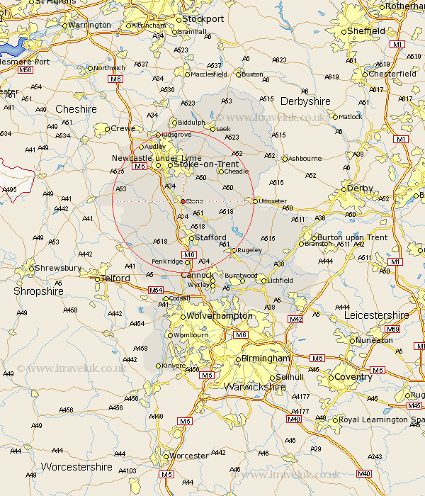
Staffordshire Map Showing Location of Stone
Population: 12074
Area Size (ha): 370
District: Stafford
Easting: 391032 Northing: 333661
Latitude: 52.9 Longitude: -2.13
 = Stone
Area Size (ha): 370
District: Stafford
Easting: 391032 Northing: 333661
Latitude: 52.9 Longitude: -2.13
= Stone
This Stone map below is supplied by Google. Use the tools in the top left corner to zoom into street level or zoom out for a road map, you may also need to zoom in to see Stone on the map. Click and drag the map to move around. If the map fails to load try and refresh your browser or zoom in or out (+ or -).
Update - it seems Google no longer allow people to use their maps for free! This Stone map sometimes loads and sometimes gives a error. I am working on a solution.
Closest 30 Towns or Cities to Stone (Population over 500)
Hilderstone 3.83km Swinnerton 5.89km Swynnerton 5.89km Barlaston 5.99km Fulford 7.13km Hopton 7.75km Eccleshall 9.6km Seighford 9.85km Draycott in the Moors 10km Draycott 10km Standon 10.23km Caverswall 10.28km Weston 10.78km Weston upon Trent 10.78km Church Leigh 11.33km Leigh 11.33km Stafford 11.34km Stoke on Trent 11.61km Stoke-on-Trent 11.61km Stoke-upon-Trent 11.61km Stoke 11.61km Stoke upon Trent 11.61km Whitmore 12.49km Checkley 12.84km Newcastle under Lyme 12.98km Newcastle-under-Lyme 12.98km Cheadle 13.67km Haughton 13.73km Keele 14.99km Gnosall 15.16km