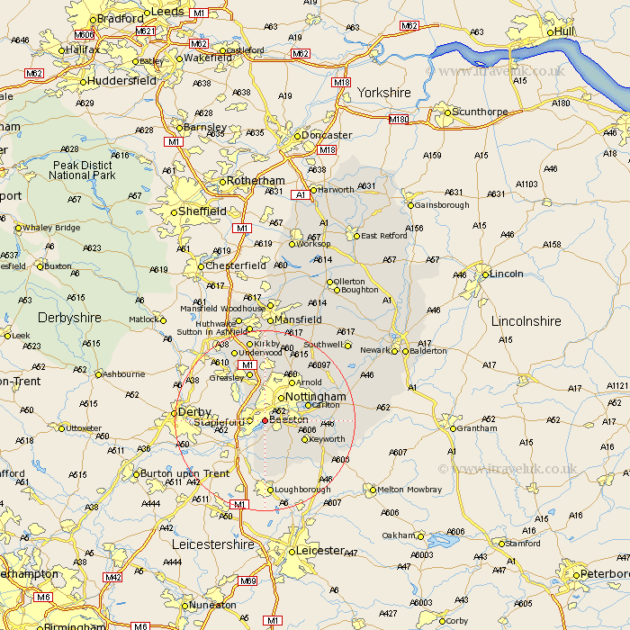
Nottinghamshire Map Showing Location of Beeston
Population: 65701
Area Size (ha): 1617
District: Broxtowe
Easting: 452665 Northing: 335797
Latitude: 52.92 Longitude: -1.22
 = Beeston
Area Size (ha): 1617
District: Broxtowe
Easting: 452665 Northing: 335797
Latitude: 52.92 Longitude: -1.22
= Beeston
This Beeston map below is supplied by Google. Use the tools in the top left corner to zoom into street level or zoom out for a road map, you may also need to zoom in to see Beeston on the map. Click and drag the map to move around. If the map fails to load try and refresh your browser or zoom in or out (+ or -).
Update - it seems Google no longer allow people to use their maps for free! This Beeston map sometimes loads and sometimes gives a error. I am working on a solution.
Closest 30 Towns or Cities to Beeston (Population over 500)
Stapleford 3.35km Trowell 4.83km Ruddington 5.81km Nottigham 6.49km Nottingham 6.49km West Bridgeford 6.7km West Bridgford 6.7km Cossall 7.13km Gotham 7.5km Kimberley 8.13km Awsworth 8.65km Tollerton 8.94km Bunny 9.29km Sutton Bonington 9.54km Carlton 9.67km Colwick 9.67km Eastwood 10.81km Arnold 10.82km Greasley 11.61km East Leake 11.61km Radcliffe-on-Trent 12.43km Radcliffe 12.43km Radcliffe on Trent 12.43km Cotgrave 12.43km Costock 12.45km Lambley 12.48km Brinsley 12.98km Burton Joyce 14.34km Shelford 14.51km Woodborough 14.99km