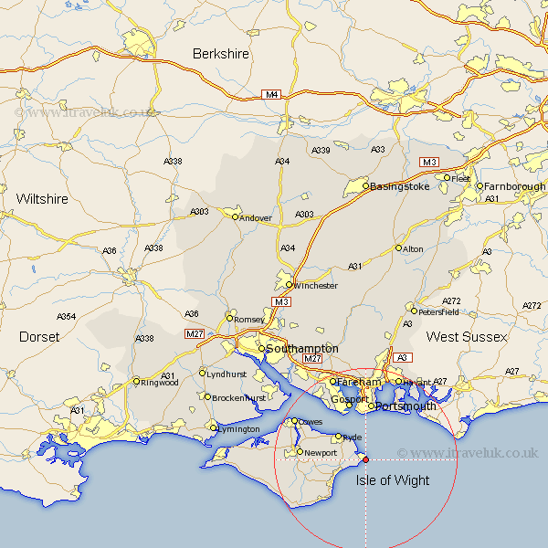
Hampshire Map Showing Location of Bembridge
Population: 3689
Area Size (ha): 166
Easting: 464752 Northing: 87540
Latitude: 50.68 Longitude: -1.08
 = Bembridge
Area Size (ha): 166
Easting: 464752 Northing: 87540
Latitude: 50.68 Longitude: -1.08
= Bembridge
This Bembridge map below is supplied by Google. Use the tools in the top left corner to zoom into street level or zoom out for a road map, you may also need to zoom in to see Bembridge on the map. Click and drag the map to move around. If the map fails to load try and refresh your browser or zoom in or out (+ or -).
Update - it seems Google no longer allow people to use their maps for free! This Bembridge map sometimes loads and sometimes gives a error. I am working on a solution.
Closest 30 Towns or Cities to Bembridge (Population over 500)
Bembridge 0km Saint Helens 2.99km St Helens 2.99km St. Helens 2.99km Seaview 3.89km Brading 4.7km Sandown 5.99km Ryde 8.08km Newchurch 8.43km Shanklin 10.23km Southsea 11.18km Wootton 11.2km Jentnor 11.64km Ventnor 11.64km Arreton 11.89km Portsmouth 12.67km Wroxall 13.2km Gosport 13.44km Godshill 13.89km Newport 14.21km Rookley 14.58km Lee on the Solent 15.35km Lee on Solent 15.35km Lee-on-Solent 15.35km Lee-on-the-Solent 15.35km Portchester 16.84km Porchester 16.84km East Cowes 16.96km Northwood 17.34km Cowes 17.85km