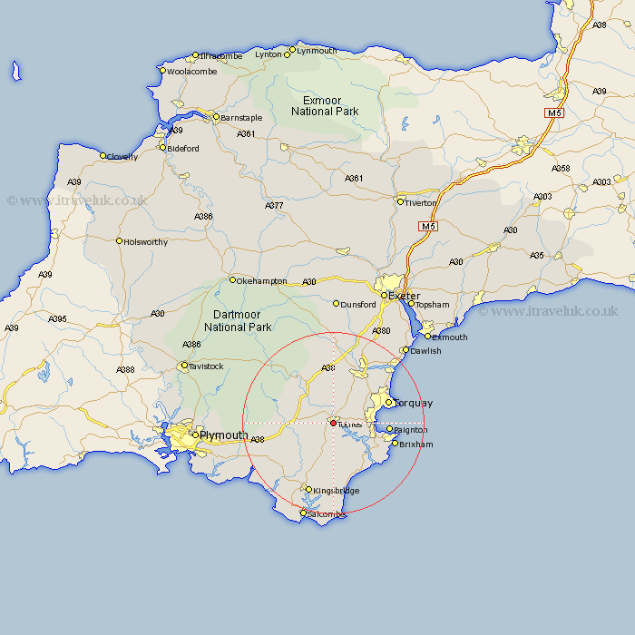
Devon Map Showing Location of Totnes
Population: 6780
Area Size (ha): 202
District: South Hams
Easting: 283972 Northing: 58764
Latitude: 50.42 Longitude: -3.69
 = Totnes
Area Size (ha): 202
District: South Hams
Easting: 283972 Northing: 58764
Latitude: 50.42 Longitude: -3.69
= Totnes
This Totnes map below is supplied by Google. Use the tools in the top left corner to zoom into street level or zoom out for a road map, you may also need to zoom in to see Totnes on the map. Click and drag the map to move around. If the map fails to load try and refresh your browser or zoom in or out (+ or -).
Update - it seems Google no longer allow people to use their maps for free! This Totnes map sometimes loads and sometimes gives a error. I am working on a solution.
Closest 30 Towns or Cities to Totnes (Population over 500)
Harberton 2.1km Berry Pomeroy 2.98km Staverton 4.69km Stoke Gabriel 5.89km Broadhempston 6.5km Diptford 7.17km Ipplepen 7.62km Marldon 7.88km Blackawton 8.5km Denbury 8.81km Buckfastleigh 9.26km Abbotskerswell 9.82km Brent 10.2km South Brent 10.2km Ashburton 11.05km Kingskerswell 11.25km Dartmouth 11.26km Kingswear 12.08km Ugborough 12.25km Paignton 12.35km East Allington 12.43km Strete 12.7km Street 12.7km Torquay 13.03km Newton Abbot 13.62km Stoke Fleming 13.63km Loddiswell 13.74km Brixham 14.24km Stokeinteignhead 15.06km Kingsteignton 15.82km