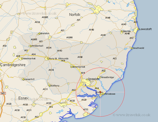
Suffolk Map Showing Location of Trimley Heath
District: Suffolk Coastal
Easting: 627723 Northing: 236891
Latitude: 51.98 Longitude: 1.32
 = Trimley Heath
Easting: 627723 Northing: 236891
Latitude: 51.98 Longitude: 1.32
= Trimley Heath
This Trimley Heath map below is supplied by Google. Use the tools in the top left corner to zoom into street level or zoom out for a road map, you may also need to zoom in to see Trimley Heath on the map. Click and drag the map to move around. If the map fails to load try and refresh your browser or zoom in or out (+ or -).
Update - it seems Google no longer allow people to use their maps for free! This Trimley Heath map sometimes loads and sometimes gives a error. I am working on a solution.
Closest 30 Towns or Cities to Trimley Heath (Population over 500)
Kirton 1.86km Kirkton 1.86km Walton 1.86km Felixstowe 2.94km Shotley 4.93km Nacton 6.81km Chelmondiston 6.85km Bucklesham 7.19km Martlesham Heath 9.55km Sutton 9.55km Holbrook 10.27km Hollesley 10.9km Martlesham 11.18km Stutton 11.56km Melton 12.98km Woodbridge 12.98km Grundisburgh 13.75km Ufford 15.01km Ipswich 15.13km Wirnesham 15.86km Witnesham 15.86km Bentley 15.98km Rendlesham 16.33km Sproughton 16.58km Sprughton 16.58km Capel St. Mary 17.22km Capel St Mary 17.22km Capel Saint Mary 17.22km Capel 17.22km Bramford 17.49km