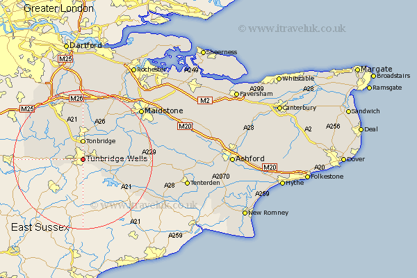
Kent Map Showing Location of Royal Tunbridge Wells
Population: 58816
Area Size (ha): 1582
District: Tunbridge Wells
Easting: 559736 Northing: 139651
Latitude: 51.13 Longitude: 0.28
 = Royal Tunbridge Wells
Area Size (ha): 1582
District: Tunbridge Wells
Easting: 559736 Northing: 139651
Latitude: 51.13 Longitude: 0.28
= Royal Tunbridge Wells
This Royal Tunbridge Wells map below is supplied by Google. Use the tools in the top left corner to zoom into street level or zoom out for a road map, you may also need to zoom in to see Royal Tunbridge Wells on the map. Click and drag the map to move around. If the map fails to load try and refresh your browser or zoom in or out (+ or -).
Update - it seems Google no longer allow people to use their maps for free! This Royal Tunbridge Wells map sometimes loads and sometimes gives a error. I am working on a solution.
Closest 30 Towns or Cities to Royal Tunbridge Wells (Population over 500)
Pembury 2.33km Bidborough 3.95km Southborough 3.95km Speldhurst 4.65km Tonbridge 5.56km Leigh 7.25km Penshurst 7.9km Paddock Wood 7.9km Brenchley 8.14km Hildenborough 8.2km Lamberhurst 8.92km Hadlow 9.91km East Peckham 10.18km Horsmonden 10.63km Chiddingstone 11.1km Weald 11.6km Goudhurst 12.21km Plaxtol 13.03km Hever 13.32km Cowden 13.96km Yalding 13.98km Mereworth 14.22km Ide Hill 15.26km Marden 15.56km Hunton 15.79km Sevenoaks 15.93km Wateringbury 15.96km Edenbridge 16.1km Borough Green 16.72km Seal 17.31km