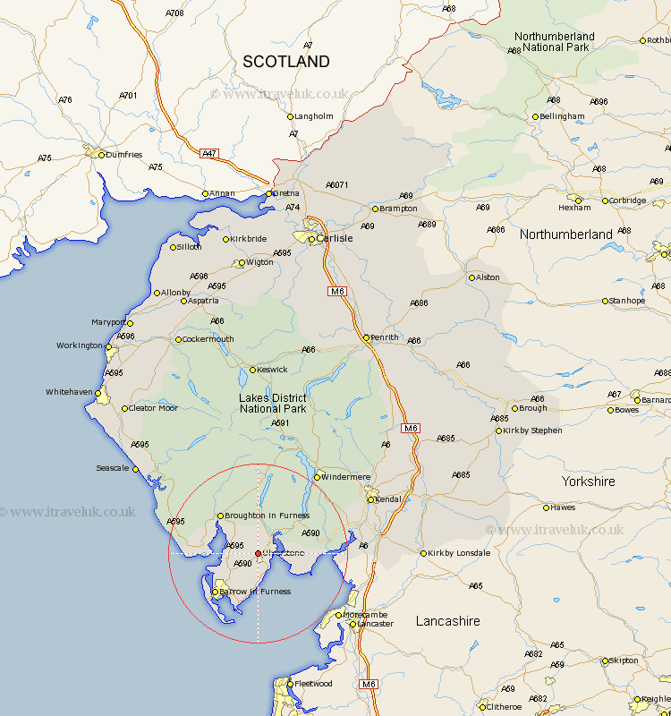
Cumbria Map Showing Location of Ulverston
Population: 11619
Area Size (ha): 283
District: South Lakeland
Easting: 328249 Northing: 478826
Latitude: 54.2 Longitude: -3.1
 = Ulverston
Area Size (ha): 283
District: South Lakeland
Easting: 328249 Northing: 478826
Latitude: 54.2 Longitude: -3.1
= Ulverston
This Ulverston map below is supplied by Google. Use the tools in the top left corner to zoom into street level or zoom out for a road map, you may also need to zoom in to see Ulverston on the map. Click and drag the map to move around. If the map fails to load try and refresh your browser or zoom in or out (+ or -).
Update - it seems Google no longer allow people to use their maps for free! This Ulverston map sometimes loads and sometimes gives a error. I am working on a solution.
Closest 30 Towns or Cities to Ulverston (Population over 500)
Pennington 2.85km Lindal 4.93km Lindal in Furness 4.93km Great Urswick 5.66km Haverthwaite 6.56km Dalton in Furness 7.05km Dalton 7.05km Askam in Furness 7.81km Askam 7.81km Colton 8.1km Lower Holker 8.87km Holker 8.87km Aldingham 9.26km Millom 10.84km Isle of Walney 15.61km Arnside 17.45km Conistan 18.66km Coniston 18.66km Bootle 18.85km Hawkshead 19.64km Levens 21.32km Beetham 21.68km Milnthorpe 21.76km Heversham 21.99km Windermere 22.03km Holme 25.01km Natland 25.56km Ambleside 25.6km Staveley 26.11km Kendall 26.18km