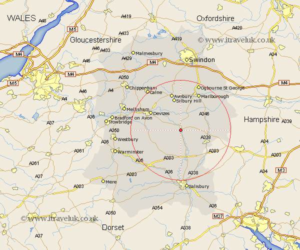
Wiltshire Map Showing Location of Upavon
Population: 1218
District: Kennet
Easting: 412784 Northing: 153871
Latitude: 51.28 Longitude: -1.82
 = Upavon
District: Kennet
Easting: 412784 Northing: 153871
Latitude: 51.28 Longitude: -1.82
= Upavon
This Upavon map below is supplied by Google. Use the tools in the top left corner to zoom into street level or zoom out for a road map, you may also need to zoom in to see Upavon on the map. Click and drag the map to move around. If the map fails to load try and refresh your browser or zoom in or out (+ or -).
Update - it seems Google no longer allow people to use their maps for free! This Upavon map sometimes loads and sometimes gives a error. I am working on a solution.
Closest 30 Towns or Cities to Upavon (Population over 500)
Upavon 0km Enford 3.88km Netheravon 6.03km Pewsey 7.24km Figheldean 7.76km Urchfont 8.32km Bulford 9.9km Lark Hill 11.12km Market Lavington 11.59km Lavington 11.59km Collingbourne Ducis 11.59km Durrington 11.65km Burbage 11.81km Tidworth 11.83km North Tidworth 11.83km Shrewton 12.54km Bishops Cannings 13.11km Amesbury 13.17km West Lavington 13.28km Devizes 13.75km Grafton 13.9km Potterne 14.39km Roundway 14.83km Lugershall 14.85km Ludgershall 14.85km Marlborough 16.38km Rowde 16.78km Erlestoke 17.39km Cherhill 17.48km Bedwyn 17.68km