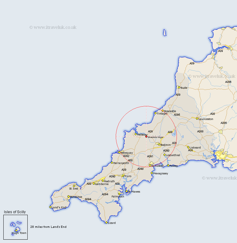
Cornwall Map Showing Location of Wadebridge
Population: 5159
Area Size (ha): 138
District: North Cornwall
Easting: 199162 Northing: 72446
Latitude: 50.52 Longitude: -4.83
 = Wadebridge
Area Size (ha): 138
District: North Cornwall
Easting: 199162 Northing: 72446
Latitude: 50.52 Longitude: -4.83
= Wadebridge
This Wadebridge map below is supplied by Google. Use the tools in the top left corner to zoom into street level or zoom out for a road map, you may also need to zoom in to see Wadebridge on the map. Click and drag the map to move around. If the map fails to load try and refresh your browser or zoom in or out (+ or -).
Update - it seems Google no longer allow people to use their maps for free! This Wadebridge map sometimes loads and sometimes gives a error. I am working on a solution.
Closest 30 Towns or Cities to Wadebridge (Population over 500)
Wadebridge 0km St. Issey 6.18km Saint Issey 6.18km St Issey 6.18km Padstow 7.31km Lanivet 8.79km Saint Merryn 9.43km St. Merryn 9.43km St Merryn 9.43km Bodmin 9.95km Blisland 10.61km St. Columb 11.66km St Columb Major 11.66km St Columb 11.66km Saint Columb 11.66km Saint Columb Major 11.66km St. Columb Major 11.66km Roche 12.98km Cardingham 13.49km Cardinham 13.49km Stenalees 14.56km Bugle 15.02km St Denis 15.25km St. Denis 15.25km Saint Dennis 15.25km St Dennis 15.25km St. Dennis 15.25km Saint Denis 15.25km Camelford 15.36km St. Blazey 15.38km