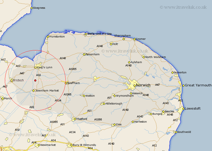
Norfolk Map Showing Location of Watlington
Population: 2031
District: King's Lynn and West Norfolk
Easting: 561147 Northing: 310369
Latitude: 52.67 Longitude: 0.38
 = Watlington
District: King's Lynn and West Norfolk
Easting: 561147 Northing: 310369
Latitude: 52.67 Longitude: 0.38
= Watlington
This Watlington map below is supplied by Google. Use the tools in the top left corner to zoom into street level or zoom out for a road map, you may also need to zoom in to see Watlington on the map. Click and drag the map to move around. If the map fails to load try and refresh your browser or zoom in or out (+ or -).
Update - it seems Google no longer allow people to use their maps for free! This Watlington map sometimes loads and sometimes gives a error. I am working on a solution.
Closest 30 Towns or Cities to Watlington (Population over 500)
Runcton 2.17km Runcton Holme 2.17km North Runcton 5.01km Tilney 6.73km Tilney St Lawrence 6.73km Tilney Saint Lawrence 6.73km Tilney St. Lawrence 6.73km Shouldham 7km Downham Market 7.5km Middleton 7.9km Lynn 9.26km Lynn Regis 9.26km Kings Lynn 9.26km King's Lynn 9.26km Denver 9.34km Clenchwarton 9.53km East Winch 10.8km Terrington Saint Clement 10.83km Terrington St. Clement 10.83km Terrington 10.83km Terrington St Clement 10.83km Marham 11.39km Wereham 11.47km Outwell 11.55km South Wootton 11.62km Walpole 12.53km Emneth 12.91km Hilgay 13.03km North Wootton 13.4km Gayton 13.45km