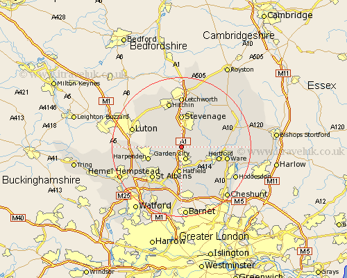
Hertfordshire Map Showing Location of Welwyn
Population: 10246
Area Size (ha): 446
District: Welwyn Hatfield
Easting: 522864 Northing: 216518
Latitude: 51.83 Longitude: -0.22
 = Welwyn
Area Size (ha): 446
District: Welwyn Hatfield
Easting: 522864 Northing: 216518
Latitude: 51.83 Longitude: -0.22
= Welwyn
This Welwyn map below is supplied by Google. Use the tools in the top left corner to zoom into street level or zoom out for a road map, you may also need to zoom in to see Welwyn on the map. Click and drag the map to move around. If the map fails to load try and refresh your browser or zoom in or out (+ or -).
Update - it seems Google no longer allow people to use their maps for free! This Welwyn map sometimes loads and sometimes gives a error. I am working on a solution.
Closest 30 Towns or Cities to Welwyn (Population over 500)
Codicote 2.18km Knebworth 2.95km Garden City 3.88km Welwyn Garden City 3.88km Tewin 4.94km Kimpton 4.94km Datchworth 4.94km Harmer Green 5.34km Wheathampstead 5.89km Aston 7.2km Hatfield 7.44km Stapleford 8.02km Bishops Hatfield 8.16km Watton at Stone 8.23km Watton 8.23km Stevenage 9.27km Sandridge 9.36km Benington 9.75km Bennington 9.75km Hertingfordbury 9.76km Harpenden 9.89km Essendon 10.34km Walkern 10.9km Hertford 10.96km Wymondley 11.12km Great Wymondley 11.12km Graveley 11.18km Brookmans Park 11.35km Colney Heath 11.35km Little Munden 12.03km