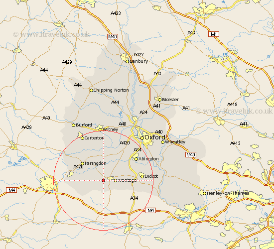
Oxfordshire Map Showing Location of Challow
Population: 184
District: Vale of White Horse
Easting: 436948 Northing: 187347
Latitude: 51.58 Longitude: -1.47
 = Challow
District: Vale of White Horse
Easting: 436948 Northing: 187347
Latitude: 51.58 Longitude: -1.47
= Challow
This Challow map below is supplied by Google. Use the tools in the top left corner to zoom into street level or zoom out for a road map, you may also need to zoom in to see Challow on the map. Click and drag the map to move around. If the map fails to load try and refresh your browser or zoom in or out (+ or -).
Update - it seems Google no longer allow people to use their maps for free! This Challow map sometimes loads and sometimes gives a error. I am working on a solution.
Closest 30 Towns or Cities to Challow (Population over 500)
Childrey 1.15km East Challow 1.15km Letcombe Regis 2.18km Wantage 4.61km Uffington 5.76km East Hanney 5.92km Hanney 5.92km Stanford in the Vale 6.02km Buckland 9.55km Kingston Bagpuize 9.9km Kingston Bagpuze 9.9km Faringdon 10.95km Steventon 11.01km Longworth 11.36km Watchfield 11.66km Marcham 11.82km Milton 12.1km Drayton 12.78km Shrivenham 12.8km Harwell 12.8km Chilton 14.31km Sutton Courtenay 14.89km Didcot 15.08km Standlake 15.23km Clanfield 15.27km Bampton 15.53km Abingdon on Thames 15.69km Abingdon-on-Thames 15.69km Abingdon 15.69km Hagbourne 16.12km