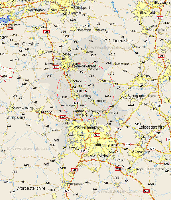
Staffordshire Map Showing Location of Weston Upon Trent
Population: 849
District: Stafford
Easting: 398877 Northing: 326238
Latitude: 52.83 Longitude: -2.02
 = Weston Upon Trent
District: Stafford
Easting: 398877 Northing: 326238
Latitude: 52.83 Longitude: -2.02
= Weston Upon Trent
This Weston Upon Trent map below is supplied by Google. Use the tools in the top left corner to zoom into street level or zoom out for a road map, you may also need to zoom in to see Weston Upon Trent on the map. Click and drag the map to move around. If the map fails to load try and refresh your browser or zoom in or out (+ or -).
Update - it seems Google no longer allow people to use their maps for free! This Weston Upon Trent map sometimes loads and sometimes gives a error. I am working on a solution.
Closest 30 Towns or Cities to Weston Upon Trent (Population over 500)
Hopton 5.6km Colwich 6km Stafford 6.72km Bednall 8.14km Abbots Bromley 9.15km Rugeley 9.29km Church Leigh 9.86km Leigh 9.86km Colton 10km Hilderstone 10.29km Stone 10.78km Seighford 11.35km Checkley 11.98km Penkridge 13km Fulford 13.4km Uttoxeter 13.42km Haughton 13.52km Armitage 14.29km Huntington 14.87km Hednesford 14.87km Draycott 14.87km Draycott in the Moors 14.87km Marchington 15.02km Longdon 15.77km Eccleshall 15.78km Swinnerton 16.31km Swynnerton 16.31km Barlaston 16.42km Gnossall 16.64km Gnosall 16.64km