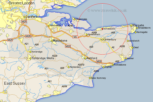
Kent Map Showing Location of Whitstable
Population: 28494
Area Size (ha): 899
District: Canterbury
Easting: 615841 Northing: 165831
Latitude: 51.36 Longitude: 1.07
 = Whitstable
Area Size (ha): 899
District: Canterbury
Easting: 615841 Northing: 165831
Latitude: 51.36 Longitude: 1.07
= Whitstable
This Whitstable map below is supplied by Google. Use the tools in the top left corner to zoom into street level or zoom out for a road map, you may also need to zoom in to see Whitstable on the map. Click and drag the map to move around. If the map fails to load try and refresh your browser or zoom in or out (+ or -).
Update - it seems Google no longer allow people to use their maps for free! This Whitstable map sometimes loads and sometimes gives a error. I am working on a solution.
Closest 30 Towns or Cities to Whitstable (Population over 500)
Chestfield 0.99km Herne Bay 4.49km Broomfield 5.61km Blean 6.67km Hoath 7.28km Hackington 8.43km Harbledown 8.76km Sturry 8.99km Canterbury 9.12km Chislet 9.46km Dunkirk 10.32km Leysdown on Sea 11.59km Leysdown-on-Sea 11.59km Leysdown 11.59km Littlebourne 12.24km St Nicholas at Wade 12.54km St. Nicholas at Wade 12.54km Saint Nicholas at Wade 12.54km Chartham 12.64km Warden 12.66km Faversham 12.7km Preston 13.09km Oare 13.78km Lower Hardres 13.94km Bridge 14.31km Wingham 14.44km Selling 14.77km Eastchurch 14.84km Monkton 15.08km Ospringe 15.56km