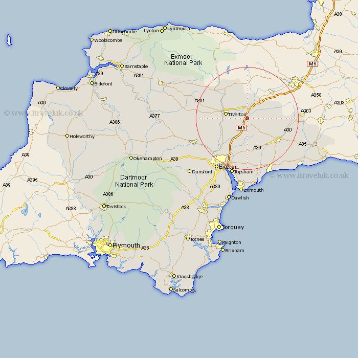
Devon Map Showing Location of Willand
Population: 2228
Area Size (ha): 59
District: Mid Devon
Easting: 303872 Northing: 110267
Latitude: 50.88 Longitude: -3.37
 = Willand
Area Size (ha): 59
District: Mid Devon
Easting: 303872 Northing: 110267
Latitude: 50.88 Longitude: -3.37
= Willand
This Willand map below is supplied by Google. Use the tools in the top left corner to zoom into street level or zoom out for a road map, you may also need to zoom in to see Willand on the map. Click and drag the map to move around. If the map fails to load try and refresh your browser or zoom in or out (+ or -).
Update - it seems Google no longer allow people to use their maps for free! This Willand map sometimes loads and sometimes gives a error. I am working on a solution.
Closest 30 Towns or Cities to Willand (Population over 500)
Uffculme 2.98km Cullompton 2.98km Kentisbeare 3.97km Halberton 3.97km Sampford Peverell 6.03km Bradninch 6.58km Plymtree 7.5km Burlescombe 8.2km Tiverton 8.39km Broadhembury 8.96km Culmstock 8.98km Holcombe Rogus 9.34km Hemyock 10.06km Payhembury 10.38km Dunkeswell 10.69km Silverton 11.05km Talaton 11.66km Whimple 13.03km Broad Clyst 13.79km Bampton 13.8km Gittisham 14.54km Rockbeare 14.87km Thorverton 14.93km Honiton 15.86km Stoke Canon 16km Ottery Saint Mary 16.41km Ottery St. Mary 16.41km Ottery St Mary 16.41km Upottery 16.48km Cheriton Fitzpaine 17.93km