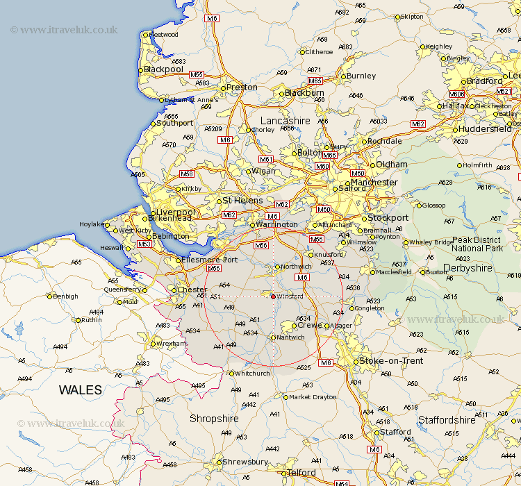
Cheshire Map Showing Location of Winsford
Population: 26507
Area Size (ha): 740
District: Vale Royal
Easting: 365476 Northing: 365290
Latitude: 53.18 Longitude: -2.52
 = Winsford
Area Size (ha): 740
District: Vale Royal
Easting: 365476 Northing: 365290
Latitude: 53.18 Longitude: -2.52
= Winsford
This Winsford map below is supplied by Google. Use the tools in the top left corner to zoom into street level or zoom out for a road map, you may also need to zoom in to see Winsford on the map. Click and drag the map to move around. If the map fails to load try and refresh your browser or zoom in or out (+ or -).
Update - it seems Google no longer allow people to use their maps for free! This Winsford map sometimes loads and sometimes gives a error. I am working on a solution.
Closest 30 Towns or Cities to Winsford (Population over 500)
Winsford 0km Whitegate 4.33km Little Budworth 5.55km Middlewick 5.55km Middlewich 5.55km Davenham 5.56km Hartford 5.99km Cuddington 7.86km Weaverham 8.64km Anderton 9.34km Northwick 9.34km Marston 9.34km Northwich 9.34km Lostock Gralam 9.85km Holmes Chapel 10.16km Delamere 10.66km Tarporley 10.66km Crewe 10.8km Acton 10.81km Plumbley 11.42km Plumley Station 11.42km Sandbach 11.44km Bunbury 11.57km Wistaston 11.61km Kelsall Hill 11.71km Kelsall 11.71km Kelshall Hill 11.71km Brereton 12.36km Brereton cum Smethwick 12.36km Nantwich 12.97km