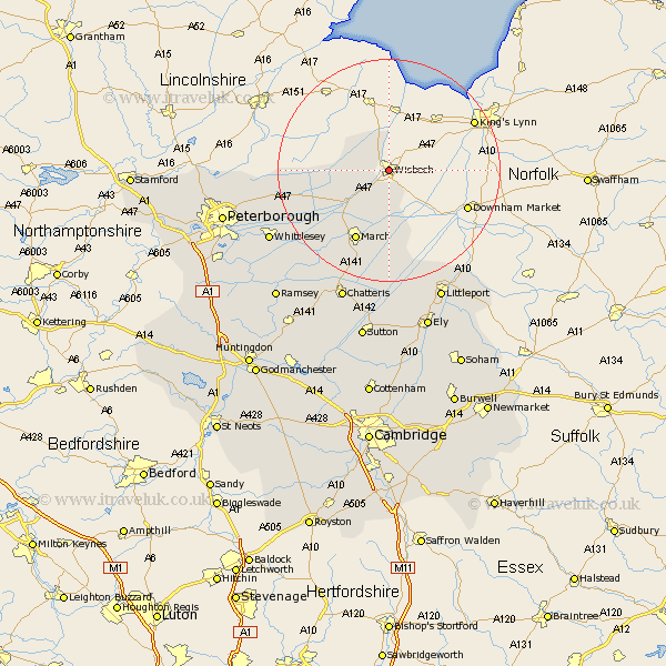
Cambridgeshire Map Showing Location of Wisbech
Population: 24566
Area Size (ha): 826
District: Fenland
Easting: 546499 Northing: 309906
Latitude: 52.67 Longitude: 0.17
 = Wisbech
Area Size (ha): 826
District: Fenland
Easting: 546499 Northing: 309906
Latitude: 52.67 Longitude: 0.17
= Wisbech
This Wisbech map below is supplied by Google. Use the tools in the top left corner to zoom into street level or zoom out for a road map, you may also need to zoom in to see Wisbech on the map. Click and drag the map to move around. If the map fails to load try and refresh your browser or zoom in or out (+ or -).
Update - it seems Google no longer allow people to use their maps for free! This Wisbech map sometimes loads and sometimes gives a error. I am working on a solution.
Closest 30 Towns or Cities to Wisbech (Population over 500)
Elm 3.88km Newton 4.33km March 14.14km Thorney 18.83km Wimblington 19.73km Manea 20.42km Doddington 21.48km Whittlesey 24.06km Eye 24.76km Chatteris 25.35km Littleport 25.73km Newborough 26.46km Downham 26.56km Peterbrough 29.61km Petersborough 29.61km Peterborough 29.61km Mepal 29.85km Northborough 30.41km Ely 30.42km Glinton 30.58km Ramsey 30.78km Farcet 30.82km Witchford 31.59km Sutton 31.83km Bury 33.14km Somersham 33.47km Stretham 33.53km Warboys 33.59km Yaxley 33.71km Orton Waterville 34.08km