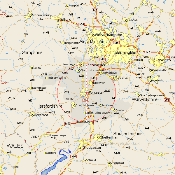
Worcestershire Map Showing Location of Worcester
Population: 82438
Area Size (ha): 2000
District: Worcester
Easting: 386332 Northing: 255815
Latitude: 52.2 Longitude: -2.2
 = Worcester
Area Size (ha): 2000
District: Worcester
Easting: 386332 Northing: 255815
Latitude: 52.2 Longitude: -2.2
= Worcester
This Worcester map below is supplied by Google. Use the tools in the top left corner to zoom into street level or zoom out for a road map, you may also need to zoom in to see Worcester on the map. Click and drag the map to move around. If the map fails to load try and refresh your browser or zoom in or out (+ or -).
Update - it seems Google no longer allow people to use their maps for free! This Worcester map sometimes loads and sometimes gives a error. I am working on a solution.
Closest 30 Towns or Cities to Worcester (Population over 500)
Fernhill Heath 3.7km Hallow 3.88km Grimley 5.03km Powick 5.03km Crowle 5.68km Holt 6.52km Kempsey 7.42km Ombersley 7.76km Droitwich 8.16km Leigh 8.17km Peopleton 8.8km Wadborough 9.87km Seven Stoke 11.18km Severn Stoke 11.18km Martley 11.94km Malvern 12.21km Great Malvern 12.21km Hanbury 12.62km Pershore 12.98km Bishampton 13.04km Hanley Castle 13.17km Astley 13.66km Great Witley 13.79km Defford 14.17km Stoke Prior 14.35km Upton 14.87km Upton on Severn 14.87km Upton-on-Severn 14.87km Upton upon Severn 14.87km Hartlebury 14.99km