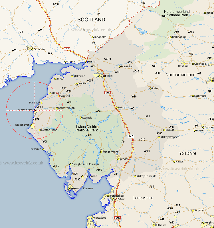
Cumbria Map Showing Location of Workington
Population: 25195
Area Size (ha): 640
District: Allerdale
Easting: 298925 Northing: 529461
Latitude: 54.65 Longitude: -3.57
 = Workington
Area Size (ha): 640
District: Allerdale
Easting: 298925 Northing: 529461
Latitude: 54.65 Longitude: -3.57
= Workington
This Workington map below is supplied by Google. Use the tools in the top left corner to zoom into street level or zoom out for a road map, you may also need to zoom in to see Workington on the map. Click and drag the map to move around. If the map fails to load try and refresh your browser or zoom in or out (+ or -).
Update - it seems Google no longer allow people to use their maps for free! This Workington map sometimes loads and sometimes gives a error. I am working on a solution.
Closest 30 Towns or Cities to Workington (Population over 500)
Flimby 4.91km Maryport 7.02km Broughton Moor 7.42km Lowca 7.49km Distington 7.72km Parton 9.32km Brigham 9.65km Dearham 10.22km Dean 10.23km Whitehaven 11.32km Crosscanonby 12.62km Bridekirk 13.38km Frizington 14.04km Cockermouth 14.06km Lamplugh 14.18km Cleator Moor 15.17km St Bees 16.99km St Bega 16.99km St. Bees 16.99km Saint Bees 16.99km St. Bega 16.99km Saint Bega 16.99km Aspatria 18.67km Egremont 20.64km Bromfield 25.48km Silloth 27.3km Gosforth 29.1km Koswick 29.5km Keswick 29.5km Seascale 30.14km