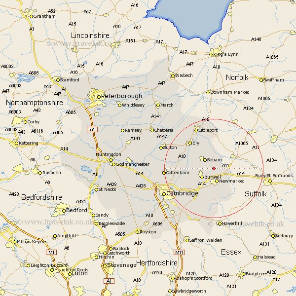
Cambridgeshire Map Showing Location of Fordham
Population: 2166
Area Size (ha): 77
District: East Cambridgeshire
Easting: 563629 Northing: 269630
Latitude: 52.3 Longitude: 0.4
 = Fordham
Area Size (ha): 77
District: East Cambridgeshire
Easting: 563629 Northing: 269630
Latitude: 52.3 Longitude: 0.4
= Fordham
This Fordham map below is supplied by Google. Use the tools in the top left corner to zoom into street level or zoom out for a road map, you may also need to zoom in to see Fordham on the map. Click and drag the map to move around. If the map fails to load try and refresh your browser or zoom in or out (+ or -).
Update - it seems Google no longer allow people to use their maps for free! This Fordham map sometimes loads and sometimes gives a error. I am working on a solution.
Closest 30 Towns or Cities to Fordham (Population over 500)
Chippenham 2.27km Isleham 3.87km Soham 5.03km Burwell 5.85km Wicken 6.8km Swaffham Prior 8.79km Cheveley 10.32km Swaffham Bulbeck 10.86km Ashley 10.86km Stetchworth 11.12km Dullingham 11.35km Bottisham 12.97km Ely 14.34km Stretham 14.5km Waterbeach 15.75km Witchford 16.44km Great Wilbraham 16.51km Wilbraham 16.51km Wilburton 16.8km Haddenham 17.88km Downham 17.98km Fulbourne 18.01km Fulbourn 18.01km Littleport 18.01km Teversham 18.47km Milton 18.56km Cottenham 19.36km Balsham 19.39km Histon 21.15km Mepal 22.23km