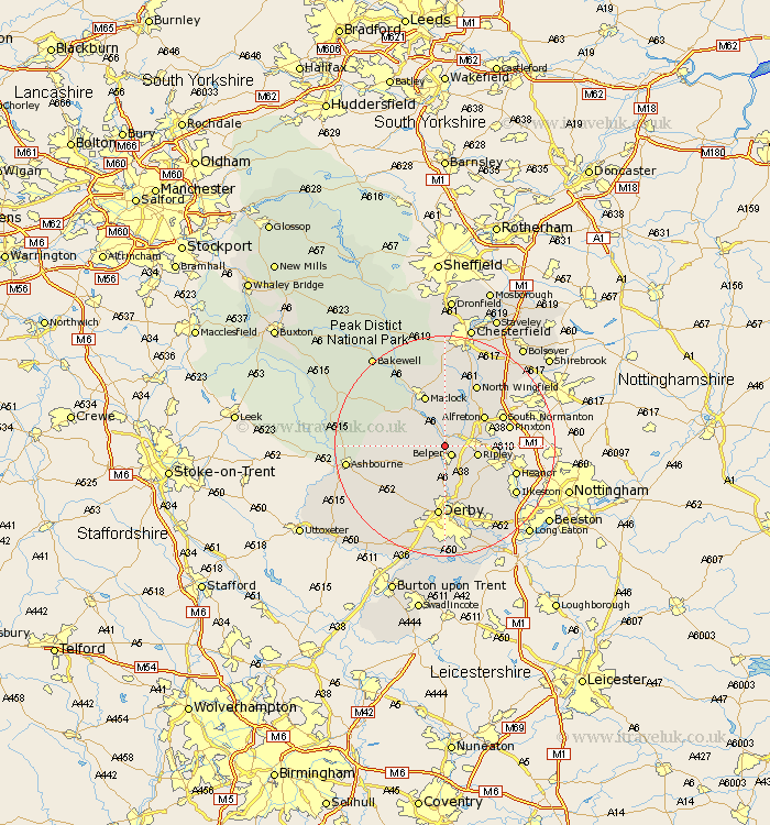
Derbyshire Map Showing Location of Ambergate
Population: 3636
Area Size (ha): 155
District: Amber Valley
Easting: 434630 Northing: 350462
Latitude: 53.05 Longitude: -1.48
 = Ambergate
Area Size (ha): 155
District: Amber Valley
Easting: 434630 Northing: 350462
Latitude: 53.05 Longitude: -1.48
= Ambergate
This Ambergate map below is supplied by Google. Use the tools in the top left corner to zoom into street level or zoom out for a road map, you may also need to zoom in to see Ambergate on the map. Click and drag the map to move around. If the map fails to load try and refresh your browser or zoom in or out (+ or -).
Update - it seems Google no longer allow people to use their maps for free! This Ambergate map sometimes loads and sometimes gives a error. I am working on a solution.
Closest 30 Towns or Cities to Ambergate (Population over 500)
Belper 2.16km Heage 2.9km Crich 3.7km South Wingfield 4.99km Wingfield 4.99km Holbrook 5.67km Swanwick 5.87km Ripley 5.87km Kilbourne 6.49km Kilburn 6.49km Kilbourn 6.49km Wirksworth 6.69km Denby 6.69km Cromford 7.87km Matlock Bath 8km Codnor 8.02km Alfreton 8.69km Duffield 9.26km Shirland 9.27km Tansley 9.53km Matlock 9.85km Bonsall 9.98km Smalley 9.99km Stretton 10.28km Quarndon 11.18km Little Eaton 11.34km Morton 11.42km South Normanton 11.46km Pinxton 11.74km Brassington 11.74km