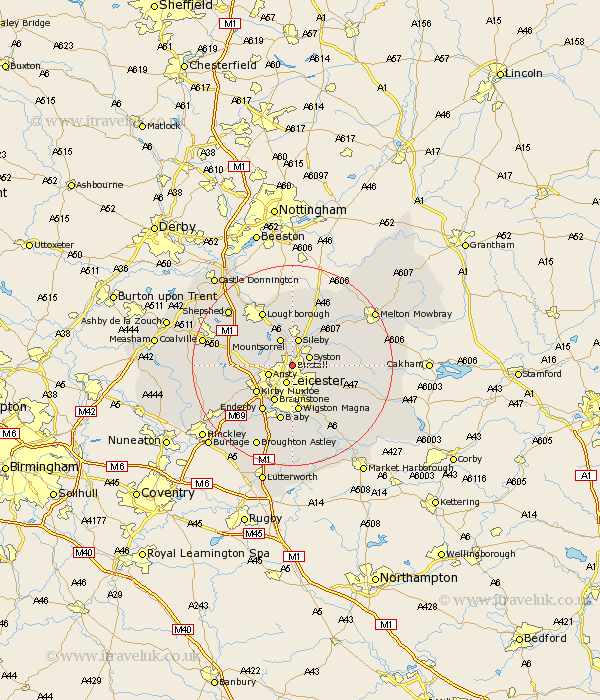
Leicestershire Map Showing Location of Birstall
Population: 11559
Area Size (ha): 250
District: Charnwood
Easting: 459729 Northing: 308066
Latitude: 52.67 Longitude: -1.12
 = Birstall
Area Size (ha): 250
District: Charnwood
Easting: 459729 Northing: 308066
Latitude: 52.67 Longitude: -1.12
= Birstall
This Birstall map below is supplied by Google. Use the tools in the top left corner to zoom into street level or zoom out for a road map, you may also need to zoom in to see Birstall on the map. Click and drag the map to move around. If the map fails to load try and refresh your browser or zoom in or out (+ or -).
Update - it seems Google no longer allow people to use their maps for free! This Birstall map sometimes loads and sometimes gives a error. I am working on a solution.
Closest 30 Towns or Cities to Birstall (Population over 500)
Syston 3.84km Rothley 3.87km Leiscester 3.88km Leicester 3.88km Anstey 4.86km Ansty 4.86km Sileby 5.68km Queniborough 5.92km Queniboro 5.92km Mountsorrel 6km Barrow upon Soar 7.74km Barrow 7.74km Woodhouse 7.9km Rearsby 7.91km Quorndon 8.14km Braunstone 8.14km Kirby Muxloe 8.74km Wigston Magna 9.34km Wigston 9.34km Oadby 9.54km Houghton-on-the-Hill 10.57km Houghton 10.57km Houghton on the Hill 10.57km Gaddesby 10.77km Hoby 10.8km Enderby 10.84km Glen Parva 11.12km Glen Parka 11.12km Burton-on-the-Wolds 11.12km Burton on the Wolds 11.12km