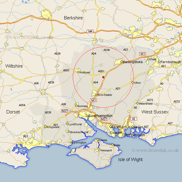
Hampshire Map Showing Location of Micheldever Station
District: Winchester
Easting: 452433 Northing: 141153
Latitude: 51.17 Longitude: -1.25
 = Micheldever Station
Easting: 452433 Northing: 141153
Latitude: 51.17 Longitude: -1.25
= Micheldever Station
This Micheldever Station map below is supplied by Google. Use the tools in the top left corner to zoom into street level or zoom out for a road map, you may also need to zoom in to see Micheldever Station on the map. Click and drag the map to move around. If the map fails to load try and refresh your browser or zoom in or out (+ or -).
Update - it seems Google no longer allow people to use their maps for free! This Micheldever Station map sometimes loads and sometimes gives a error. I am working on a solution.
Closest 30 Towns or Cities to Micheldever Station (Population over 500)
Micheldever 3.89km Wonston 5.01km North Waltham 5.94km Overton 7.41km Dummer 7.89km Whitchurch 8.04km Barton Stacey 8.14km Kings Worthy 9.91km Oakley 10.36km Longparish 10.62km New Alresford 10.95km Chilbolton 12.92km Winchester 13.09km Medstead 13.95km Cheriton 14.22km Sparsholt 14.5km Four Marks 15.02km Basingstoke 16.07km Ropley 16.09km Clatford 16.27km Lower Clatford 16.27km Goodworth Clatford 16.27km Upper Clatford 16.37km Kingsclere 16.68km Andover 16.68km Burghclere 17.31km Twyford 17.32km Bramdean 17.51km Compton 17.67km Hurstbourne Tarrant 17.82km