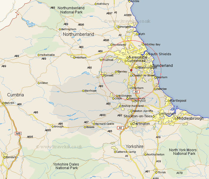
Durham Map Showing Location of Birtley
Population: 11377
District: Gateshead
Easting: 427797 Northing: 554378
Latitude: 54.88 Longitude: -1.57
 = Birtley
District: Gateshead
Easting: 427797 Northing: 554378
Latitude: 54.88 Longitude: -1.57
= Birtley
This Birtley map below is supplied by Google. Use the tools in the top left corner to zoom into street level or zoom out for a road map, you may also need to zoom in to see Birtley on the map. Click and drag the map to move around. If the map fails to load try and refresh your browser or zoom in or out (+ or -).
Update - it seems Google no longer allow people to use their maps for free! This Birtley map sometimes loads and sometimes gives a error. I am working on a solution.
Closest 30 Towns or Cities to Birtley (Population over 500)
Pelton 2.82km Ouston Moor 2.86km Ouston 2.86km Washington New Town 3.7km Washington 3.7km Chester-le-Street 3.7km Lamesley 4.28km Edmondsley 5.65km Houghton le Spring 7.39km Gateshead-on-Tyne 7.59km Gateshead on Tyne 7.59km Gateshead 7.59km Felling 7.98km Sacriston 8.07km West Rainton 8.55km Stanley 9.18km Whickham 9.3km Burnopfield 9.77km West Boldon 9.79km Boldon 9.79km Hebburn 9.81km Hebburn-on-Tyne 9.81km Hebburn on Tyne 9.81km Witton Gilbert 10.2km Hetton le Hole 10.52km Pittington 10.69km Langley Park 11.26km Rowlands Gill 11.28km Annfield Plain 11.29km Murton 12.13km