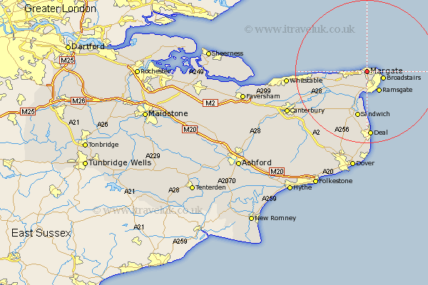
Kent Map Showing Location of Margate
Population: 57066
Area Size (ha): 1211
District: Thanet
Easting: 637711 Northing: 170512
Latitude: 51.38 Longitude: 1.39
 = Margate
Area Size (ha): 1211
District: Thanet
Easting: 637711 Northing: 170512
Latitude: 51.38 Longitude: 1.39
= Margate
This Margate map below is supplied by Google. Use the tools in the top left corner to zoom into street level or zoom out for a road map, you may also need to zoom in to see Margate on the map. Click and drag the map to move around. If the map fails to load try and refresh your browser or zoom in or out (+ or -).
Update - it seems Google no longer allow people to use their maps for free! This Margate map sometimes loads and sometimes gives a error. I am working on a solution.
Closest 30 Towns or Cities to Margate (Population over 500)
Saint Peters 2.78km St Peters 2.78km Saint Peter's 2.78km Thanet 2.78km St. Peters 2.78km St Peter Extra 2.78km St. Peter Extra 2.78km Manston 3.95km Broadstairs 4.77km Birchington 6.29km Ramsgate 6.43km Minster 8.86km Monkton 9.08km Saint Nicholas at Wade 10.18km St Nicholas at Wade 10.18km St. Nicholas at Wade 10.18km Sandwich 13.21km Chislet 14.1km Preston 14.11km Worth 15.04km Hoath 16.26km Broomfield 16.81km Wingham 17.54km Staple 17.6km Herne Bay 17.68km Eastry 17.73km Sholden 18.53km Deal 18.55km Northbourne 18.89km Littlebourne 20.04km