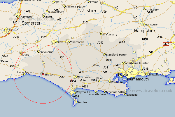
Dorset Map Showing Location of Bridport
Population: 11531
Area Size (ha): 327
District: West Dorset
Easting: 349428 Northing: 92940
Latitude: 50.73 Longitude: -2.76
 = Bridport
Area Size (ha): 327
District: West Dorset
Easting: 349428 Northing: 92940
Latitude: 50.73 Longitude: -2.76
= Bridport
This Bridport map below is supplied by Google. Use the tools in the top left corner to zoom into street level or zoom out for a road map, you may also need to zoom in to see Bridport on the map. Click and drag the map to move around. If the map fails to load try and refresh your browser or zoom in or out (+ or -).
Update - it seems Google no longer allow people to use their maps for free! This Bridport map sometimes loads and sometimes gives a error. I am working on a solution.
Closest 30 Towns or Cities to Bridport (Population over 500)
Bradpole 1.64km Loders 2.82km Chideock 4.61km Burton Bradstock 4.65km Netherbury 5.58km Beaminster 7.43km Broadwindsor 9.76km Broadwinsor 9.76km Charmouth 10.09km Lyme Regis 12.43km Thorncombe 12.86km Mosterton 13km Abbotsbury 13.29km Maiden Newton 13.87km Portesham 15.29km Portisham 15.29km Leigh 20.76km Charminster 21.58km Cerne Abbas 21.7km Chickerell 22.25km West Chickerel 22.25km Dorchester 22.84km Yetminster 22.84km Bincombe 23.5km Bradford Abbas 23.75km Buckland Newton 24.26km Piddletrenthide 24.55km Puddletrenthide 24.55km Overcombe 25.3km Weymouth 25.59km