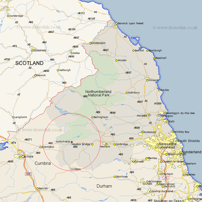
Northumberland Map Showing Location of Haltwhistle
Population: 3773
Area Size (ha): 110
District: Tynedale
Easting: 372271 Northing: 565505
Latitude: 54.98 Longitude: -2.43
 = Haltwhistle
Area Size (ha): 110
District: Tynedale
Easting: 372271 Northing: 565505
Latitude: 54.98 Longitude: -2.43
= Haltwhistle
This Haltwhistle map below is supplied by Google. Use the tools in the top left corner to zoom into street level or zoom out for a road map, you may also need to zoom in to see Haltwhistle on the map. Click and drag the map to move around. If the map fails to load try and refresh your browser or zoom in or out (+ or -).
Update - it seems Google no longer allow people to use their maps for free! This Haltwhistle map sometimes loads and sometimes gives a error. I am working on a solution.
Closest 30 Towns or Cities to Haltwhistle (Population over 500)
Haydon Bridge 12.9km Newbrough 16.06km Wark 16.63km Warden 19.14km Humshaugh 19.92km Acomb 21.27km Hexham 21.35km Challerton 21.97km Chollerton 21.97km Bellingham 22.49km Sandhoe 24.46km Corbridge 26.65km Slaley 27.18km Riding 30.31km Ridingmill 30.31km Otterburn 31.01km Stocksfield 33.45km Ovingham 36.21km Stamfordham 36.56km Wylam 37.27km Prudhoe 37.42km Ponteland 44.19km Newburn 44.71km Woolsington 47.98km Dinnington 48.39km Rothbury 50.23km Stannington 50.54km Longhorsley 50.7km Morpeth 51.92km Gosforth 52.13km