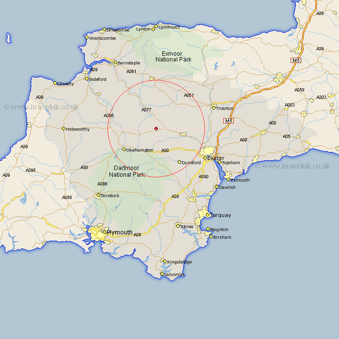
Devon Map Showing Location of Zeal Monachorum
Population: 398
District: Mid Devon
Easting: 272039 Northing: 103541
Latitude: 50.82 Longitude: -3.82
 = Zeal Monachorum
District: Mid Devon
Easting: 272039 Northing: 103541
Latitude: 50.82 Longitude: -3.82
= Zeal Monachorum
This Zeal Monachorum map below is supplied by Google. Use the tools in the top left corner to zoom into street level or zoom out for a road map, you may also need to zoom in to see Zeal Monachorum on the map. Click and drag the map to move around. If the map fails to load try and refresh your browser or zoom in or out (+ or -).
Update - it seems Google no longer allow people to use their maps for free! This Zeal Monachorum map sometimes loads and sometimes gives a error. I am working on a solution.
Closest 30 Towns or Cities to Zeal Monachorum (Population over 500)
Nymet Tracey 1.86km Bow 1.86km Copplestone 5.04km Lapford 5.68km Morchard Bishop 5.97km North Tawton 6.14km Chawleigh 9.34km Sampford Courtney 10.08km Sampford Courtnay 10.08km Sampford Courtenay 10.08km Sandford 10.54km South Tawton 10.97km Cheriton Bishop 10.97km Chulmleigh 11.66km Crediton 12.29km Witheridge 13.15km Drewsteignton 13.19km Tedburn St Mary 13.19km Tedburn Saint Mary 13.19km Tedburn St. Mary 13.19km Cheriton Fitzpaine 14.53km Chagford 14.88km Okehampton 15.88km Barrington 15.99km Burrington 15.99km Newton St Cyres 16.21km St. Cyres 16.21km St Cyres 16.21km Saint Cyres 16.21km Newton St. Cyres 16.21km