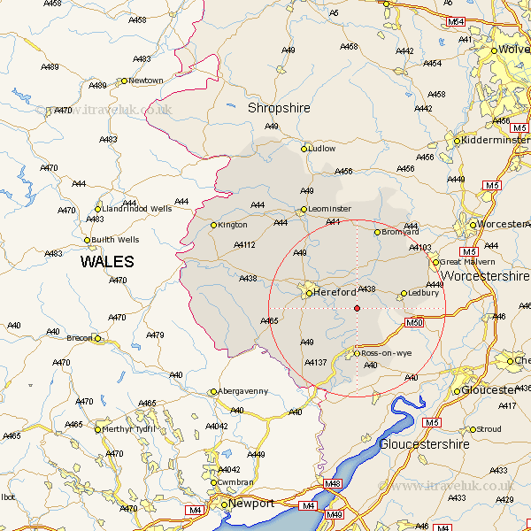
Herefordshire Map Showing Location of Woolhope
Population: 459
Easting: 361116 Northing: 235562
Latitude: 52.02 Longitude: -2.57
 = Woolhope
Easting: 361116 Northing: 235562
Latitude: 52.02 Longitude: -2.57
= Woolhope
This Woolhope map below is supplied by Google. Use the tools in the top left corner to zoom into street level or zoom out for a road map, you may also need to zoom in to see Woolhope on the map. Click and drag the map to move around. If the map fails to load try and refresh your browser or zoom in or out (+ or -).
Update - it seems Google no longer allow people to use their maps for free! This Woolhope map sometimes loads and sometimes gives a error. I am working on a solution.
Closest 30 Towns or Cities to Woolhope (Population over 500)
Fownhope 2.94km Much Marcle 4.93km Mordiford 5.87km Lugwardine 7.96km Upton Bishop 8.17km Withington 10.32km Bullingham 10.43km Bosbury 10.89km Hereford 10.91km Ledbury 10.91km Ross 11.12km Ross-on-wye 11.12km Ross on Wye 11.12km Weston 11.35km Weston under Penyard 11.35km Weston-under-Penyard 11.35km Much Birch 11.68km Sutton 12.22km Much Dewchurch 13.09km Lea 13.76km Colwall 14.56km Moreton 14.68km Moreton on Lugg 14.68km Moreton-on-Lugg 14.68km Allensmore 14.83km Walford 15.01km Burghill 16.52km Bodenham 16.83km Goodrich 17.03km Cradley 17.07km