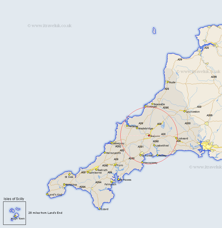
Cornwall Map Showing Location of Bodmin
Population: 12554
Area Size (ha): 362
District: North Cornwall
Easting: 207227 Northing: 66578
Latitude: 50.47 Longitude: -4.72
 = Bodmin
Area Size (ha): 362
District: North Cornwall
Easting: 207227 Northing: 66578
Latitude: 50.47 Longitude: -4.72
= Bodmin
This Bodmin map below is supplied by Google. Use the tools in the top left corner to zoom into street level or zoom out for a road map, you may also need to zoom in to see Bodmin on the map. Click and drag the map to move around. If the map fails to load try and refresh your browser or zoom in or out (+ or -).
Update - it seems Google no longer allow people to use their maps for free! This Bodmin map sometimes loads and sometimes gives a error. I am working on a solution.
Closest 30 Towns or Cities to Bodmin (Population over 500)
Lanivet 4km Cardinham 5.07km Cardingham 5.07km Blisland 6.04km Saint Blazey 7.42km St. Blazey 7.42km St Blazey 7.42km Lostwithiel 8.22km Wadebridge 9.95km Stenalees 10.59km Bugle 10.99km Roche 11.1km Par 12.98km Tywardreath 13.19km Lanreath 14.1km Dobwalls 14.28km Saint Issey 14.63km St Issey 14.63km St. Issey 14.63km St. Denis 15.01km St. Dennis 15.01km Saint Dennis 15.01km St Denis 15.01km Saint Denis 15.01km St Dennis 15.01km Lansallos 15.38km St. Columb 15.78km Saint Columb Major 15.78km St. Columb Major 15.78km Saint Columb 15.78km