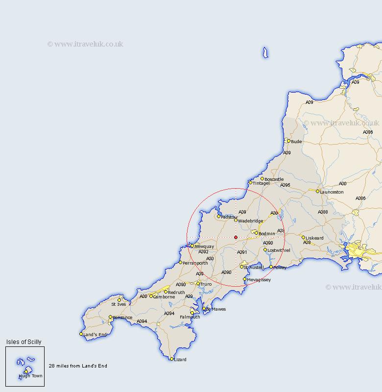
Cornwall Map Showing Location of Withiel
Population: 351
District: North Cornwall
Easting: 198879 Northing: 65031
Latitude: 50.45 Longitude: -4.83
 = Withiel
District: North Cornwall
Easting: 198879 Northing: 65031
Latitude: 50.45 Longitude: -4.83
= Withiel
This Withiel map below is supplied by Google. Use the tools in the top left corner to zoom into street level or zoom out for a road map, you may also need to zoom in to see Withiel on the map. Click and drag the map to move around. If the map fails to load try and refresh your browser or zoom in or out (+ or -).
Update - it seems Google no longer allow people to use their maps for free! This Withiel map sometimes loads and sometimes gives a error. I am working on a solution.
Closest 30 Towns or Cities to Withiel (Population over 500)
Lanivet 4.72km Roche 5.56km St Columb 7.32km Saint Columb 7.32km St. Columb Major 7.32km St. Columb 7.32km St Columb Major 7.32km Saint Columb Major 7.32km Stenalees 7.34km Wadebridge 7.42km Bugle 7.78km St Issey 8.1km St. Issey 8.1km Saint Issey 8.1km Saint Dennis 8.22km Saint Denis 8.22km St Denis 8.22km St. Denis 8.22km St. Dennis 8.22km St Dennis 8.22km Bodmin 8.47km St Blazey 9.96km St. Blazey 9.96km Saint Blazey 9.96km Padstow 11.65km St. Merryn 12km Saint Merryn 12km St Merryn 12km Blisland 12.95km Lostwithiel 13.05km