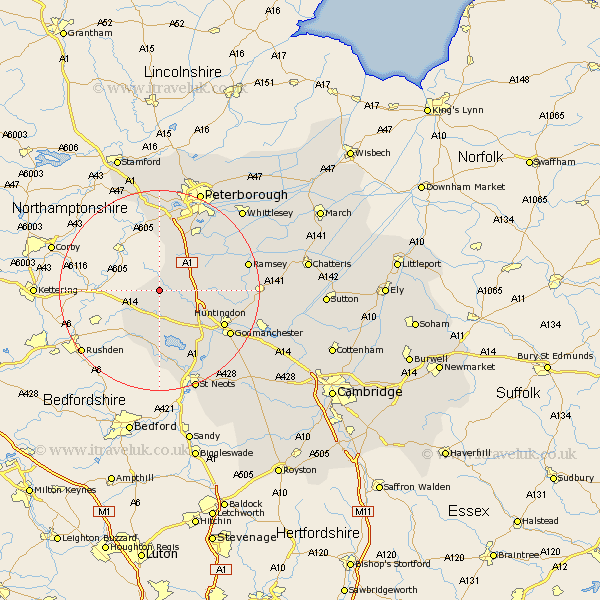
Cambridgeshire Map Showing Location of Winwick
Population: 81
District: Huntingdonshire
Easting: 511112 Northing: 279295
Latitude: 52.4 Longitude: -0.37
 = Winwick
District: Huntingdonshire
Easting: 511112 Northing: 279295
Latitude: 52.4 Longitude: -0.37
= Winwick
This Winwick map below is supplied by Google. Use the tools in the top left corner to zoom into street level or zoom out for a road map, you may also need to zoom in to see Winwick on the map. Click and drag the map to move around. If the map fails to load try and refresh your browser or zoom in or out (+ or -).
Update - it seems Google no longer allow people to use their maps for free! This Winwick map sometimes loads and sometimes gives a error. I am working on a solution.
Closest 30 Towns or Cities to Winwick (Population over 500)
Sawtry 7.73km Alconbury 7.73km Spaldwick 7.75km Folksworth 10.31km Stilton 10.85km Ellington 10.85km Kimbolton 11.18km Holme 11.69km Graffham 12.48km Grafham 12.48km Brampton 12.95km Brampton Grange 12.95km Yaxley 13.64km Huntingdon 14.49km Elton 14.87km Great Staughton 14.99km Buckden 15.21km Godmanchester 16.44km Durolipons 16.44km Offord 17.22km Offord Cluny 17.22km Orton Waterville 17.28km Farcet 17.36km Ramsey 17.84km Wistow 18.09km Bury 18.18km Little Paxton 18.47km Wyton 18.52km Castor 18.67km Hemingford 19.34km