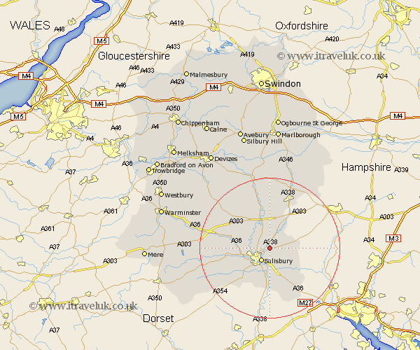
Wiltshire Map Showing Location of Winterbourne
Population: 2161
Area Size (ha): 88
District: Salisbury
Easting: 417502 Northing: 133499
Latitude: 51.1 Longitude: -1.75
 = Winterbourne
Area Size (ha): 88
District: Salisbury
Easting: 417502 Northing: 133499
Latitude: 51.1 Longitude: -1.75
= Winterbourne
This Winterbourne map below is supplied by Google. Use the tools in the top left corner to zoom into street level or zoom out for a road map, you may also need to zoom in to see Winterbourne on the map. Click and drag the map to move around. If the map fails to load try and refresh your browser or zoom in or out (+ or -).
Update - it seems Google no longer allow people to use their maps for free! This Winterbourne map sometimes loads and sometimes gives a error. I am working on a solution.
Closest 30 Towns or Cities to Winterbourne (Population over 500)
Idmiston 4.37km New Sarum 4.37km Salisbury 4.37km Winterslow 6.11km Farley 7.25km Britford 7.51km Alderbury 7.51km Amesbury 7.77km Odstock 7.77km South Newton 8.15km Wilton 8.36km Durrington 9.34km Coombe Bissett 10.19km Combebissett 10.19km Lark Hill 10.37km Bulford 11.18km Downton 11.18km Lugershall 13.13km Ludgershall 13.13km Whiteparish 13.13km Figheldean 13.18km Redlynch 13.18km Steeple Langford 13.32km Longford 13.32km Shrewton 13.97km Bishopstone 13.99km Netheravon 15km Broad Chalke 15.81km Tidworth 15.92km North Tidworth 15.92km