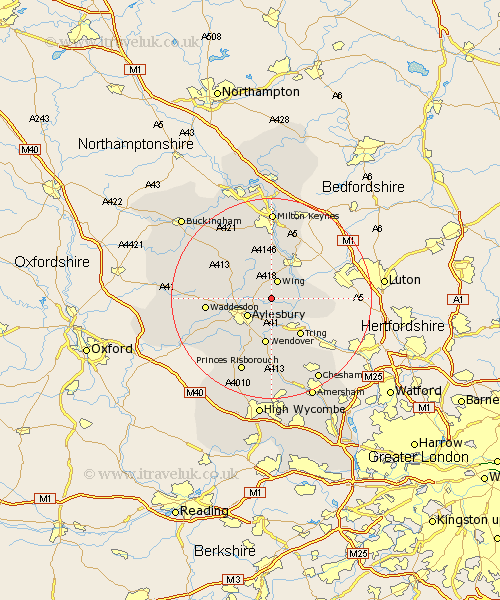
Buckinghamshire Map Showing Location of Wingrave
District: Aylesbury Vale
Easting: 487237 Northing: 217630
Latitude: 51.85 Longitude: -0.73
 = Wingrave
Easting: 487237 Northing: 217630
Latitude: 51.85 Longitude: -0.73
= Wingrave
This Wingrave map below is supplied by Google. Use the tools in the top left corner to zoom into street level or zoom out for a road map, you may also need to zoom in to see Wingrave on the map. Click and drag the map to move around. If the map fails to load try and refresh your browser or zoom in or out (+ or -).
Update - it seems Google no longer allow people to use their maps for free! This Wingrave map sometimes loads and sometimes gives a error. I am working on a solution.
Closest 30 Towns or Cities to Wingrave (Population over 500)
Wing 3.88km Cheddington 4.94km Buckland 5.68km Aston Clinton 5.68km Marsworth 5.89km Aylesbury 5.89km Slapton 7.11km Halton 7.42km Stewkley 7.5km Weston Turville 7.5km Whitechurch 7.8km Whitchurch 7.8km Stoke Mandeville 8.17km Ivinghoe 8.23km Pitstone 8.83km Soulbury 9.34km Wendover 9.34km Stone 9.76km North Marston 9.88km Edlesborough 10.3km Mursley 10.89km Stoke Hammond 11.18km Great Brickhill 11.64km Ellesborough 11.64km Quainton 12.73km Waddesdon 12.73km Newton Longville 13.18km Great Kimble 13.76km Kimble 13.76km Winslow 14.4km