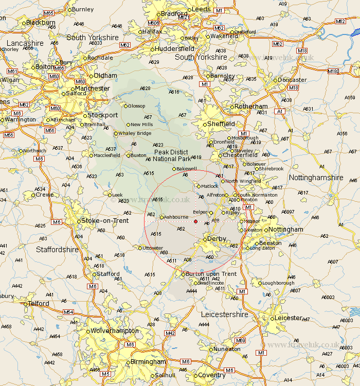
Derbyshire Map Showing Location of Windley
Population: 159
District: Amber Valley
Easting: 430196 Northing: 344871
Latitude: 53 Longitude: -1.55
 = Windley
District: Amber Valley
Easting: 430196 Northing: 344871
Latitude: 53 Longitude: -1.55
= Windley
This Windley map below is supplied by Google. Use the tools in the top left corner to zoom into street level or zoom out for a road map, you may also need to zoom in to see Windley on the map. Click and drag the map to move around. If the map fails to load try and refresh your browser or zoom in or out (+ or -).
Update - it seems Google no longer allow people to use their maps for free! This Windley map sometimes loads and sometimes gives a error. I am working on a solution.
Closest 30 Towns or Cities to Windley (Population over 500)
Holbrook 5.58km Duffield 5.8km Quarndon 6.49km Belper 6.69km Ambergate Junction Station 7.13km Ambergate 7.13km Brailsford 7.13km Kirk Langley 7.5km Heage 7.65km Kilbourne 7.81km Kilburn 7.81km Kilbourn 7.81km Derby 8.14km Little Eaton 8.7km Wirksworth 9.33km Breadsall 9.99km Denby 10.21km Crich 10.28km Ripley 10.7km Cromford 11.17km Smalley 11.31km Brassington 11.42km South Wingfield 12.11km Wingfield 12.11km Matlock Bath 12.13km Ashbourne 12.41km Swanwick 12.47km Codnor 12.81km Burnaston 13.02km Bonsall 13.17km