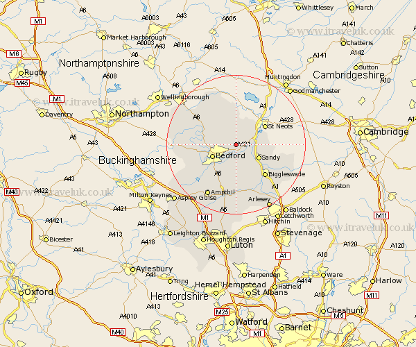
Bedfordshire Map Showing Location of Wilden
Population: 412
District: Bedford
Easting: 510558 Northing: 253325
Latitude: 52.17 Longitude: -0.38
 = Wilden
District: Bedford
Easting: 510558 Northing: 253325
Latitude: 52.17 Longitude: -0.38
= Wilden
This Wilden map below is supplied by Google. Use the tools in the top left corner to zoom into street level or zoom out for a road map, you may also need to zoom in to see Wilden on the map. Click and drag the map to move around. If the map fails to load try and refresh your browser or zoom in or out (+ or -).
Update - it seems Google no longer allow people to use their maps for free! This Wilden map sometimes loads and sometimes gives a error. I am working on a solution.
Closest 30 Towns or Cities to Wilden (Population over 500)
Great Barford 2.94km Willington 3.88km Cople 5.56km Bolnhurst 5.67km Roxton 5.68km Thurleigh 5.86km Blunham 5.87km Tempsford 5.98km Clapham 7.07km Sandy 7.39km Bedford 7.57km Northill 8.7km Biddenham 8.78km Oakley 9.09km Milton Ernest 9.28km Bromham 9.28km Elstow 9.35km Kempston 10.08km Riseley 10.86km Everton 10.89km Stevington 11.37km Pavenham 11.51km Wilhamstead 11.63km Willshamstead 11.63km Wilshamstead 11.63km Wilstead 11.63km Sharnbrook 11.64km Biggleswade 12.22km Wootton 13km Haynes 13.18km