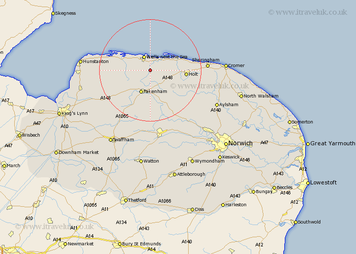
Norfolk Map Showing Location of Wighton
Population: 203
District: North Norfolk
Easting: 593832 Northing: 339403
Latitude: 52.92 Longitude: 0.88
 = Wighton
District: North Norfolk
Easting: 593832 Northing: 339403
Latitude: 52.92 Longitude: 0.88
= Wighton
This Wighton map below is supplied by Google. Use the tools in the top left corner to zoom into street level or zoom out for a road map, you may also need to zoom in to see Wighton on the map. Click and drag the map to move around. If the map fails to load try and refresh your browser or zoom in or out (+ or -).
Update - it seems Google no longer allow people to use their maps for free! This Wighton map sometimes loads and sometimes gives a error. I am working on a solution.
Closest 30 Towns or Cities to Wighton (Population over 500)
Walsingham 3.71km Little Walsingham 3.71km Wells 5.99km Wells-next-the-Sea 5.99km Wells-on-Sea 5.99km Wells next the Sea 5.99km Wells on Sea 5.99km Little Snoring 7.5km Sculthorpe 8.66km South Creake 8.66km Blakeney 9.59km Fakenham 9.86km Burnham Market 10.71km Ryburgh 11.34km Great Ryburgh 11.34km Mellon Constable 12.5km Melton Constable 12.5km Colkirk 13.17km Syderstone 13.42km Holt 13.54km Tattersett 13.69km Tatterset 13.69km Hindolveston 14.27km Briston 14.37km East Rudham 15.77km Brancaster 16.59km Foulham 17.33km Foulsham 17.33km Weybourne 17.97km Docking 17.98km