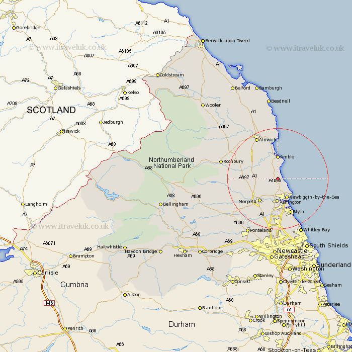
Northumberland Map Showing Location of Widdrington
Population: 158
District: Castle Morpeth
Easting: 426485 Northing: 595174
Latitude: 55.25 Longitude: -1.58
 = Widdrington
District: Castle Morpeth
Easting: 426485 Northing: 595174
Latitude: 55.25 Longitude: -1.58
= Widdrington
This Widdrington map below is supplied by Google. Use the tools in the top left corner to zoom into street level or zoom out for a road map, you may also need to zoom in to see Widdrington on the map. Click and drag the map to move around. If the map fails to load try and refresh your browser or zoom in or out (+ or -).
Update - it seems Google no longer allow people to use their maps for free! This Widdrington map sometimes loads and sometimes gives a error. I am working on a solution.
Closest 30 Towns or Cities to Widdrington (Population over 500)
East Chevington 3.7km Ellington 3.85km Lynemouth 4.85km Thirston 7.34km East Thirston 7.34km Felton 8.27km Newbiggin-by-the-Sea 8.7km Newbiggin by the Sea 8.7km Amble 9.26km Ashington 9.58km Hebron 9.76km Pegswood 9.79km Swarland 11.01km Morpeth 11.23km Warkworth 11.32km Longhorsley 11.77km Hepscott 11.9km Bedlington 13.07km Longframlington 13.2km Shilbottle 14.44km Lesbury 14.97km Lisburg 14.97km Blyth 15.04km Blythe 15.04km Alnmouth 16.71km Stannington 17.5km Almwick 18.24km Alnwick 18.24km Dudley 19.17km Seaton Sluice 19.21km