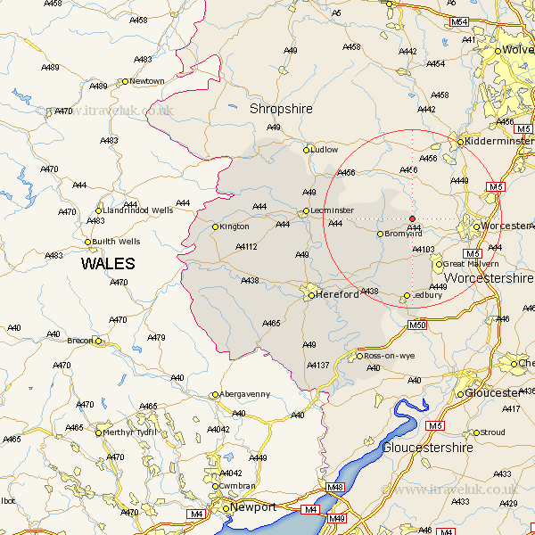
Herefordshire Map Showing Location of Whitbourne
Population: 796
Easting: 372675 Northing: 257729
Latitude: 52.22 Longitude: -2.4
 = Whitbourne
Easting: 372675 Northing: 257729
Latitude: 52.22 Longitude: -2.4
= Whitbourne
This Whitbourne map below is supplied by Google. Use the tools in the top left corner to zoom into street level or zoom out for a road map, you may also need to zoom in to see Whitbourne on the map. Click and drag the map to move around. If the map fails to load try and refresh your browser or zoom in or out (+ or -).
Update - it seems Google no longer allow people to use their maps for free! This Whitbourne map sometimes loads and sometimes gives a error. I am working on a solution.
Closest 30 Towns or Cities to Whitbourne (Population over 500)
Bromyard 7.76km Cradley 14.12km Colwall 14.88km Bosbury 15.22km Ledbury 18.57km Withington 20.54km Bodenham 20.69km Brimfield 22.42km Leominster 22.78km Sutton 23.28km Lugwardine 23.86km Mordiford 24.44km Luston 24.47km Much Marcle 25.05km Orleton 25.56km Wellington 25.61km Moreton on Lugg 26.18km Moreton-on-Lugg 26.18km Moreton 26.18km Kingsland 27.49km Fownhope 27.7km Burghill 28.18km Croft 28.22km Hereford 28.47km Bullingham 29.72km Credenhill 30.22km Eardisland 30.66km Upton Bishop 30.71km Shobdon 32km Dilwyn 32.02km