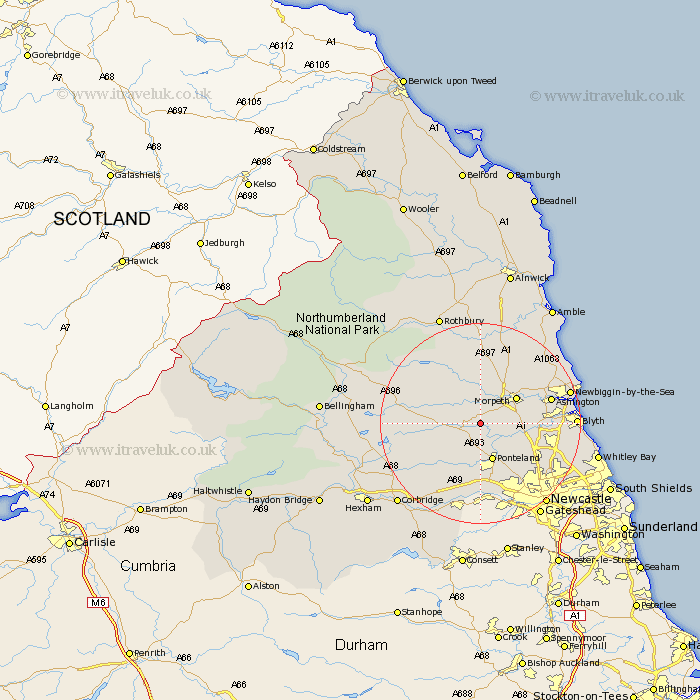
Northumberland Map Showing Location of Whalton
Population: 427
District: Castle Morpeth
Easting: 413818 Northing: 580284
Latitude: 55.12 Longitude: -1.78
 = Whalton
District: Castle Morpeth
Easting: 413818 Northing: 580284
Latitude: 55.12 Longitude: -1.78
= Whalton
This Whalton map below is supplied by Google. Use the tools in the top left corner to zoom into street level or zoom out for a road map, you may also need to zoom in to see Whalton on the map. Click and drag the map to move around. If the map fails to load try and refresh your browser or zoom in or out (+ or -).
Update - it seems Google no longer allow people to use their maps for free! This Whalton map sometimes loads and sometimes gives a error. I am working on a solution.
Closest 30 Towns or Cities to Whalton (Population over 500)
Stannington 7.65km Ponteland 7.71km Morpeth 8.44km Hepscott 9.25km Hebron 9.76km Dinnington 9.77km Stamfordham 10.68km Pegswood 11.04km Bedlington 12.7km Woolsington 12.81km Dudley 12.88km Longhorsley 13.01km Ashington 13.57km Cramlington 13.89km Seghill 16.6km Killingworth 16.62km Shiremoor 16.66km Gosforth 16.76km Newburn 16.98km Blyth 17.12km Blythe 17.12km Wylam 17.21km Newbiggin by the Sea 17.27km Newbiggin-by-the-Sea 17.27km Ovingham 17.5km Ellington 17.69km Seaton Delaval 17.86km Longframlington 18.53km Lynemouth 18.68km Long Benton 18.94km